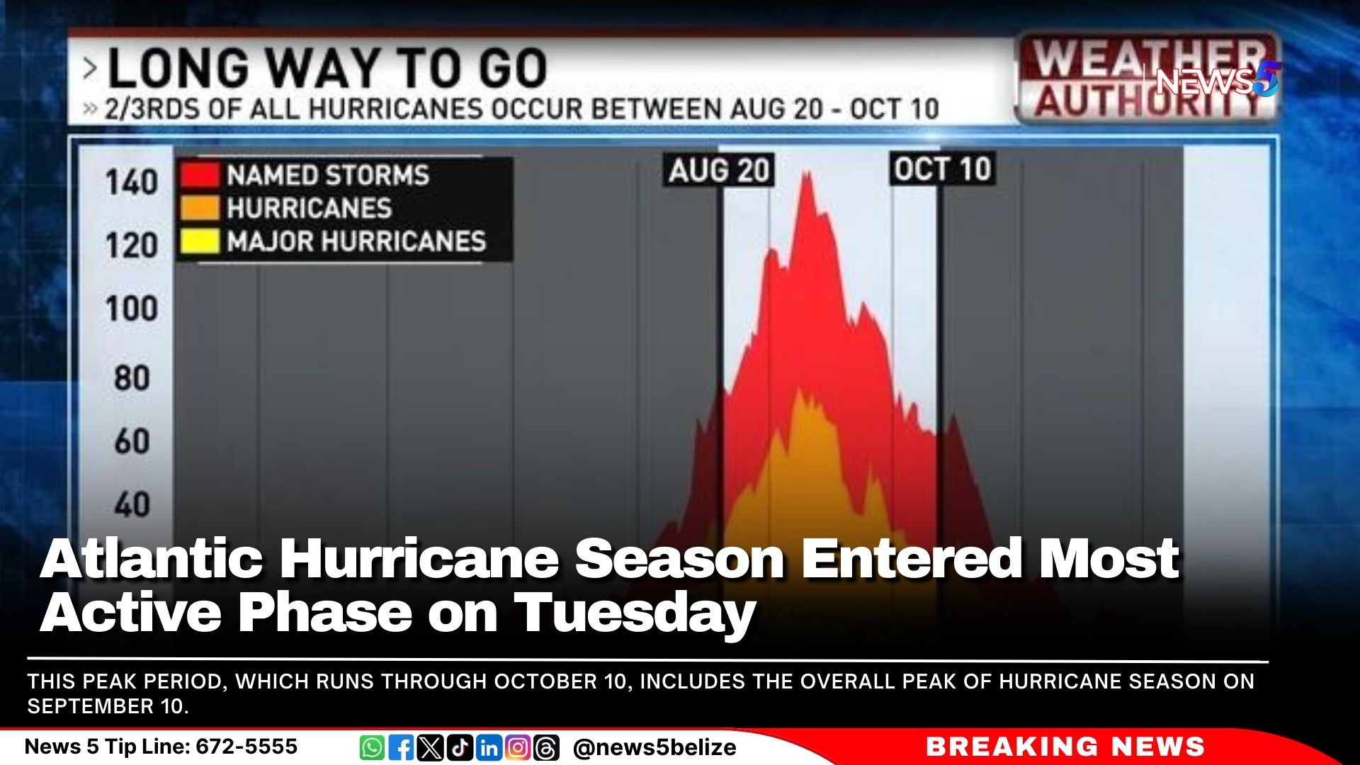
The Atlantic hurricane season officially began on June 1, but on Tuesday, we entered the “season within the season”—the period when tropical activity in the Atlantic is at its most intense.
This peak period, which runs through October 10, includes the overall peak of hurricane season on September 10. Remarkably, two-thirds of all hurricanes occur during this time as activity surges.
This surge is fuelled by a combination of atmospheric conditions across a vast area of the Atlantic, including low wind shear, warm sea surface temperatures, increased moisture, and atmospheric instability. These factors come together most powerfully from August through mid-October, creating an ideal environment for the formation and intensification of tropical systems. September, in particular, is the most active month, with a large area of the Atlantic becoming a hotspot for development.
During this period, tropical waves emerging from Africa and moving into the Atlantic are often more organised and developed, increasing their chances of evolving into hurricanes.
While the likelihood of hurricane formation decreases after mid-October as atmospheric conditions become less favourable and potential formation areas shrink, the threat persists until the official end of the season on November 30.
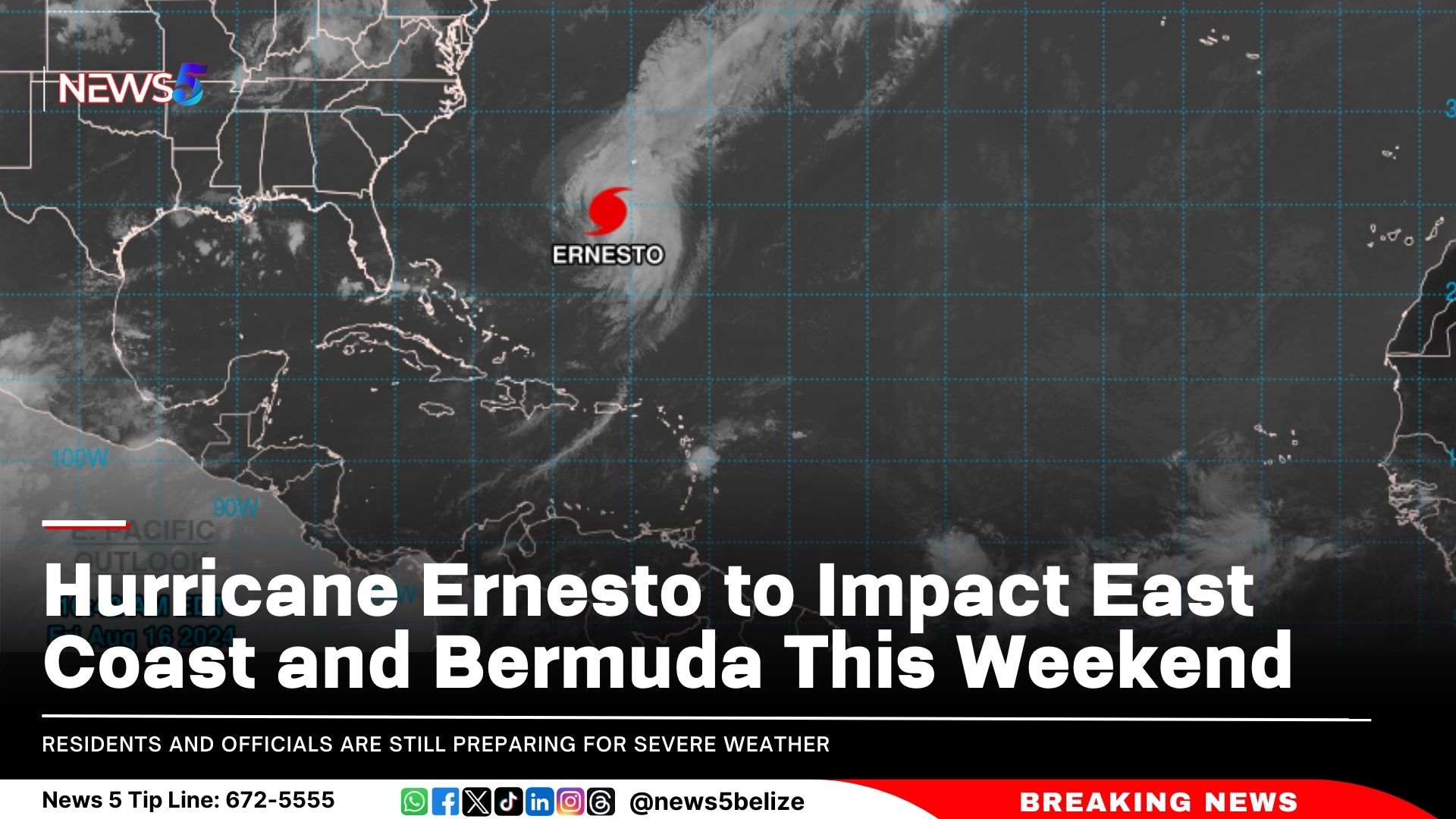
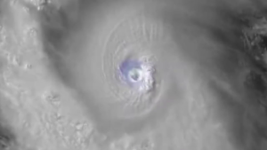
Hurricane Ernesto is rapidly closing in on Bermuda as a Category 2 storm. Although Ernesto is showing signs of weakening this morning due to vertical wind shear, residents and officials are still preparing for severe weather. The National Hurricane Center (NHC) reported that as of 8 a.m. Friday, Ernesto was 255 miles south-southwest of Bermuda, with sustained winds of 100 mph. NHC maintains a hurricane warning is in effect for Bermuda, and they anticipate life-threatening flash flooding, especially in low-lying areas.
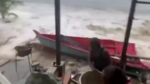
The Category 2 hurricane, which recently battered Puerto Rico and the Virgin Islands, left hundreds of thousands without power. In Puerto Rico, about 200,000 customers were still without power on Friday morning, reported CNN. The Virgin Islands reported over 10,000 customers without power.
As Ernesto continues its path, it is expected to move close to Atlantic Canada. Swells from Ernesto will affect the U.S. East Coast and other regions, including the Turks and Caicos, the Bahamas, Bermuda, and Atlantic Canada. Beachgoers should be cautious of dangerous surf and rip currents.
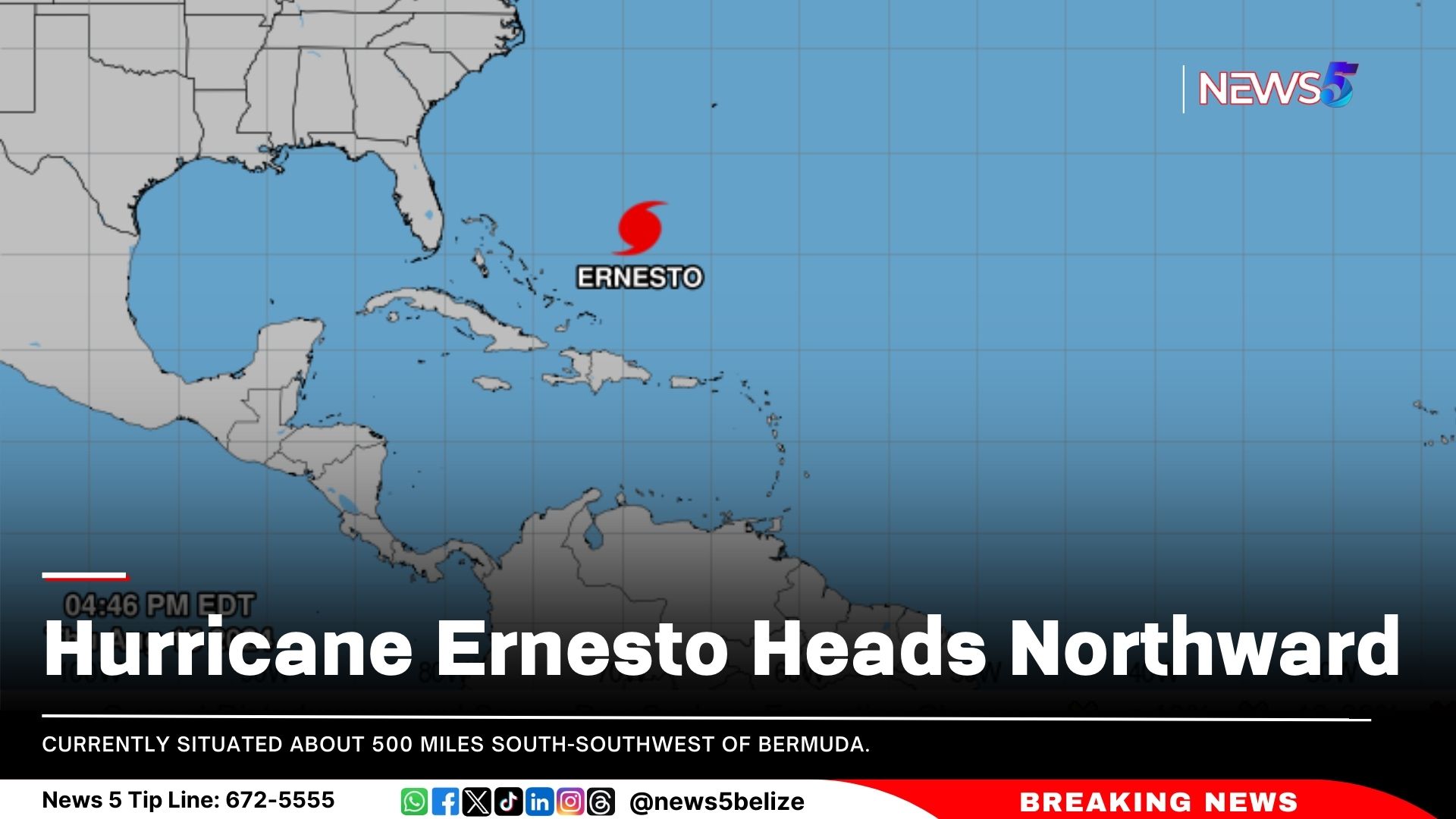
The National Hurricane Centre (NHC) continues to monitor Hurricane Ernesto, currently situated about 500 miles south-southwest of Bermuda. Ernesto is moving north at 12 knots, with maximum sustained winds of 75 knots and gusts up to 90 knots. The storm’s minimum central pressure is estimated at 975 mb.
The NHC has indicated that no new tropical cyclone formation is expected in the North Atlantic, Caribbean Sea, or Gulf of Mexico over the next seven days.
In Belize, the 24-hour forecast predicts isolated showers or thunderstorms between Friday afternoon and Saturday midday. There may be a few more showers or storms over the southern regions on Friday night and Saturday morning.
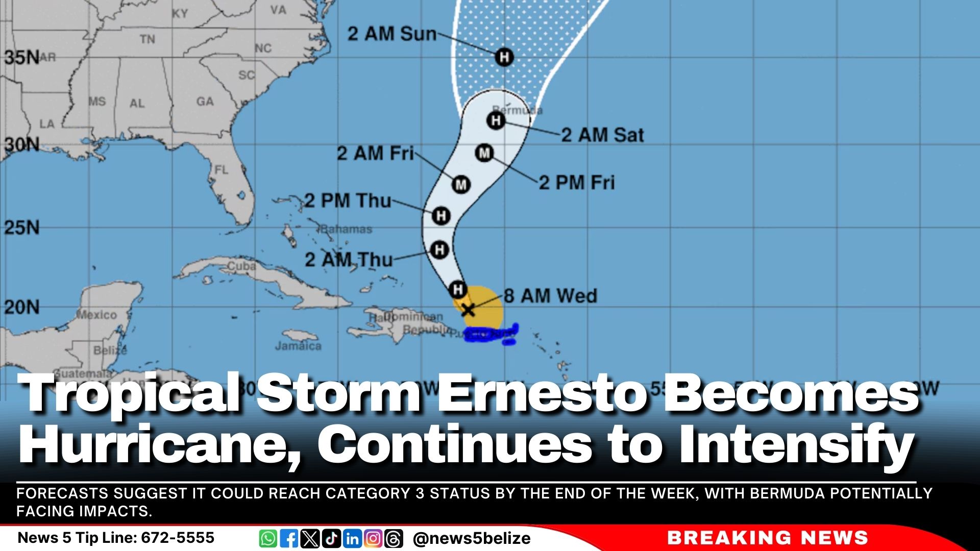
The National Hurricane Centre reported that Tropical Storm Ernesto has strengthened into a Category 1 hurricane. The storm is currently located approximately 175 miles northwest of San Juan, Puerto Rico, after passing over the Virgin Islands on Tuesday. Ernesto is moving northwest at 16 mph with maximum sustained winds of 75 mph.
The storm is expected to move into open Atlantic waters later today and could strengthen into a major hurricane. Forecasts suggest it could reach Category 3 status by the end of the week, with Bermuda potentially facing impacts.
In Belize, moist and unstable conditions will persist, but are expected to decrease over the next 24 to 48 hours. The forecast includes cloudy periods with a few showers and thunderstorms, gradually diminishing.
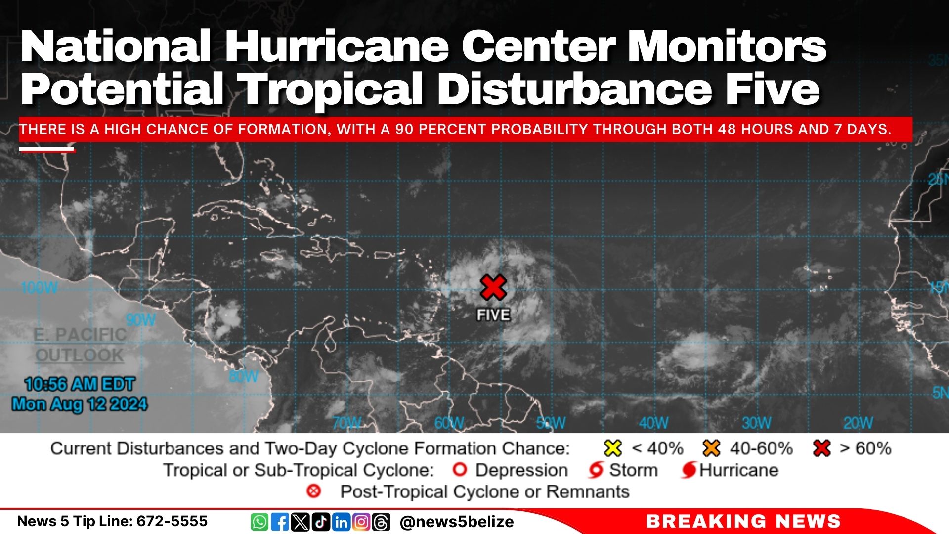
The National Hurricane Center issues advisories on potential tropical cyclone Five. The disturbance is currently a few hundred miles east of the Lesser Antilles.
There is a high chance of formation, with a 90 percent probability through both 48 hours and 7 days.
The next named storm for the 2024 Atlantic hurricane season will be Ernesto.
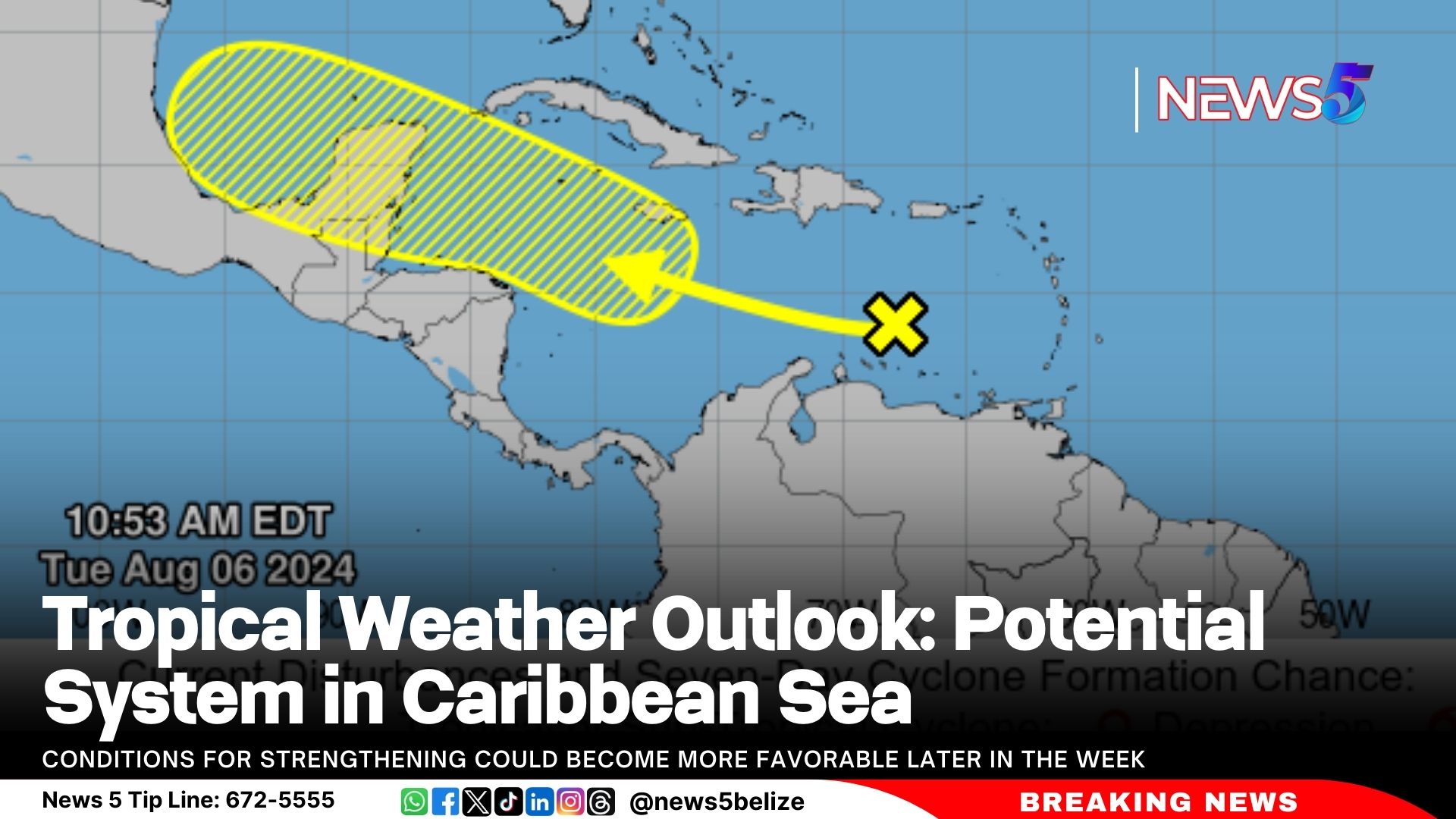
The National Hurricane Center reports that a tropical wave currently situated over the east-central Caribbean Sea is showing minimal changes this morning. The system is expected to progress westward across the central Caribbean Sea, with slow development anticipated over the next couple of days. Conditions for strengthening could become more favourable later in the week as the system approaches the western Caribbean Sea or southern Gulf of Mexico.
Currently, the likelihood of formation within the next 48 hours remains low at 10 percent. Over the next seven days, the chance increases slightly to 30 percent. The situation will continue to be monitored closely.
The National Hurricane Center reports that Tropical Storm Debby made landfall as a Category 1 hurricane near Steinhatchee, Florida, early Monday, unleashing heavy rains and strong winds.
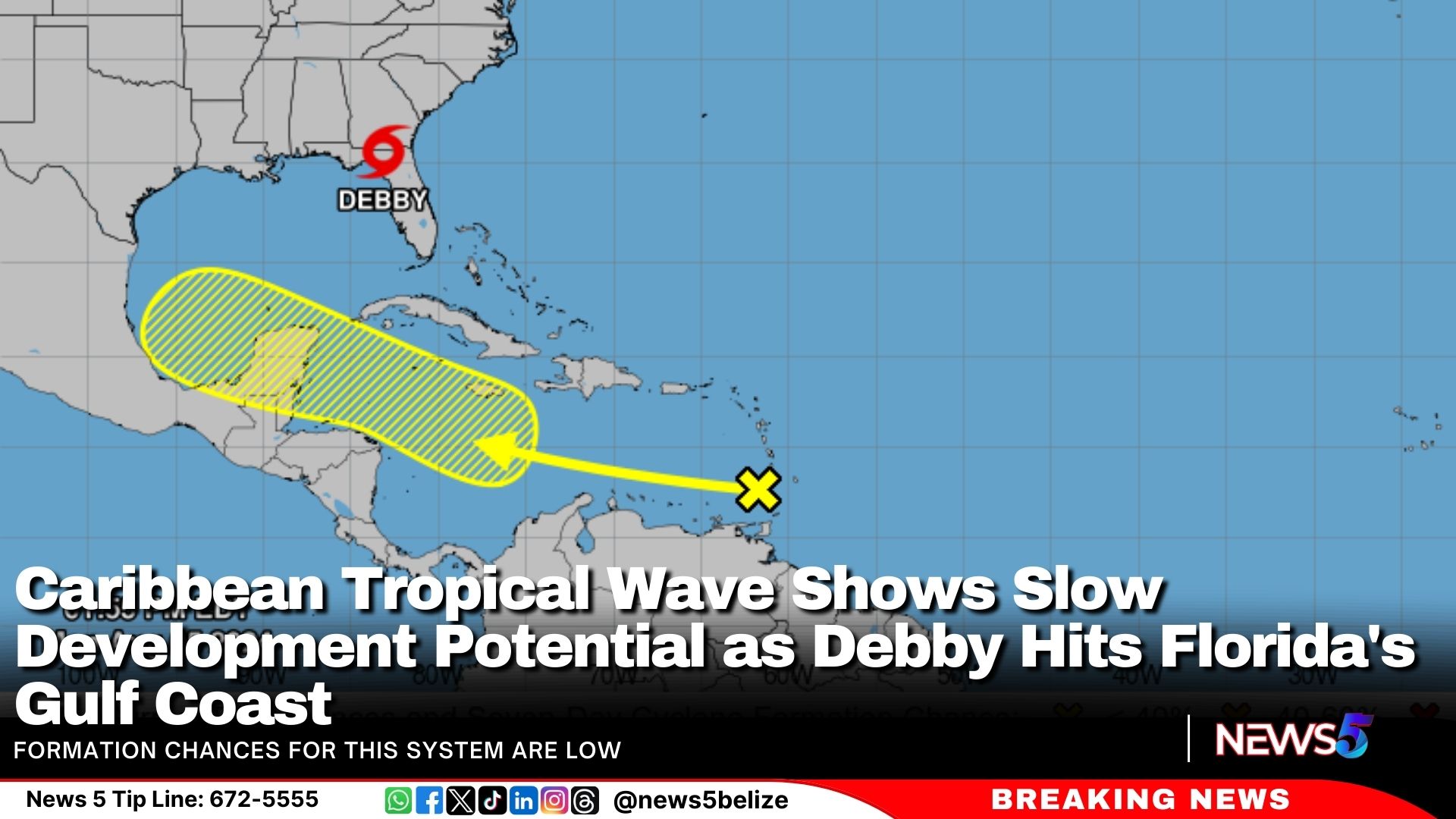
In the Caribbean, a tropical wave near the Windward Islands is producing minimal activity. Development of this system is expected to be slow over the next few days as it progresses westward. However, conditions may become more favourable later in the week as it moves across the western Caribbean Sea or the southern Gulf of Mexico.
Formation chances for this system are low, with a 10 percent chance through 48 hours and a 30 percent chance over the next 7 days.
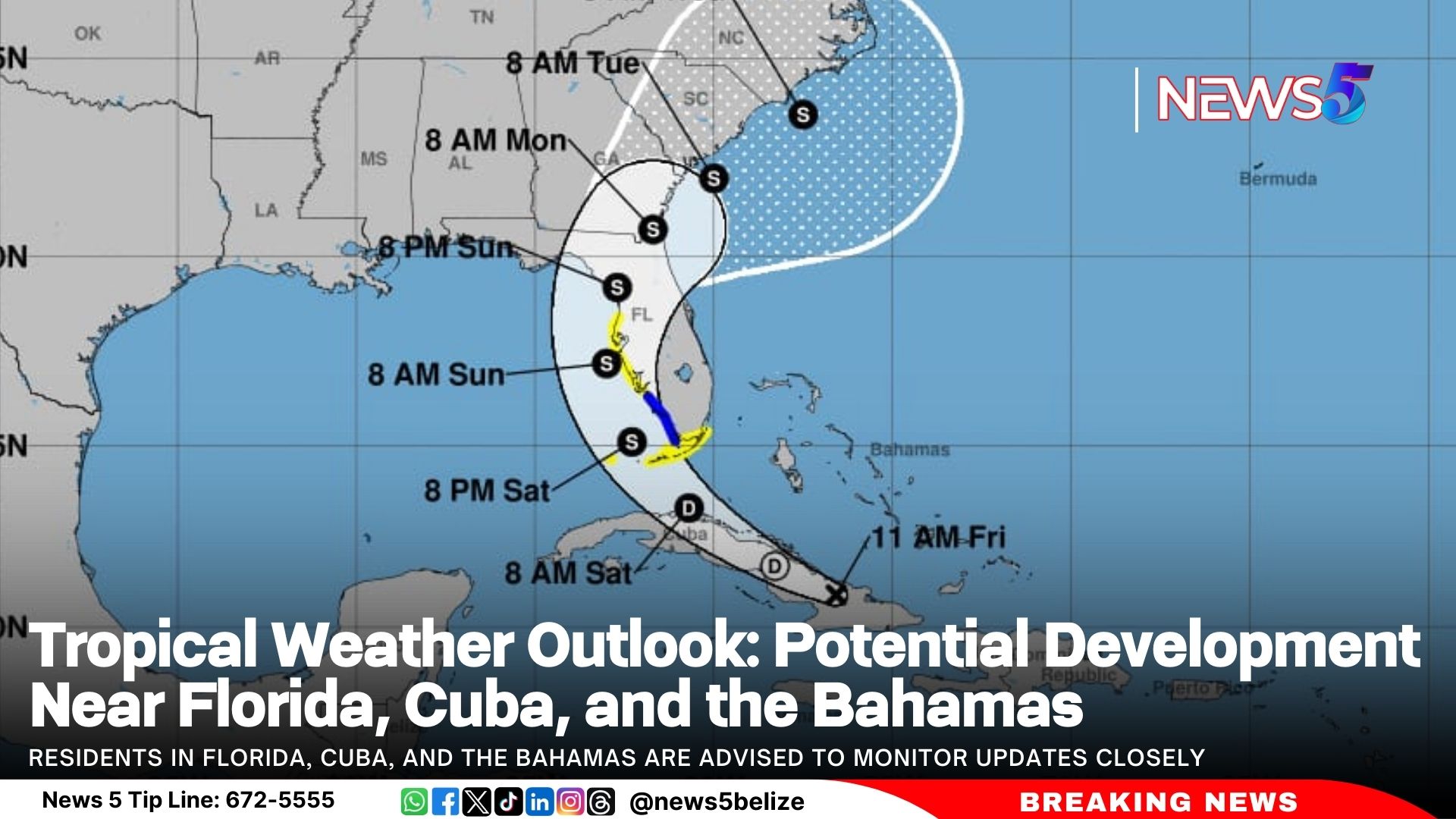
The NOAA reports that a well-defined tropical wave is currently causing scattered showers and thunderstorms across eastern Cuba, Hispaniola, the southeastern Bahamas, and Jamaica, along with adjacent waters. The system is expected to continue moving over Cuba today and enter the Straits of Florida by tonight or Saturday.
Environmental conditions are predicted to be favourable for further development, with a tropical depression likely forming this weekend over the Straits of Florida or eastern Gulf of Mexico. Tropical storm watches or warnings may be issued for parts of Florida later today.
Residents in Florida, Cuba, and the Bahamas are advised to monitor updates closely. A NOAA Hurricane Hunter aircraft is scheduled to investigate the system later today. Regardless of development, heavy rainfall is anticipated, which could lead to flash flooding in these areas.
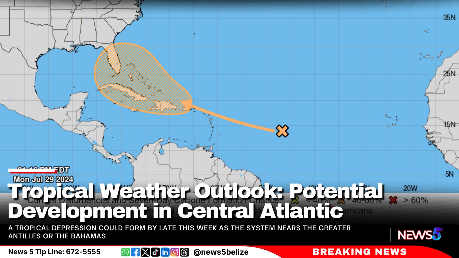
The National Hurricane Center (NHC) has issued a tropical weather outlook for the central Atlantic Ocean. An area of disturbed weather, currently situated over the central tropical Atlantic, is expected to interact with an approaching tropical wave in the coming days. Forecast models suggest that environmental conditions may become favorable for gradual development. A tropical depression could form by late this week as the system nears the Greater Antilles or the Bahamas.
At present, the likelihood of formation within the next 48 hours remains low, near 0 percent. However, there is a 50 percent chance of development over the next seven days.
The Caribbean is two months into the 2024 Atlantic Hurricane Season and one major storm has already swept through the region. Hurricane Beryl broke records by being the earliest recorded major storm to form in June, causing widespread destruction across the Caribbean. The severity of this storm is attributed to climate change, as it developed faster and earlier in the year than storms of a similar nature. Today, News Five’s Britney Gordon sat down with a few climate change experts to learn why this phenomenon is occurring and how climate change impacts the way Caribbean countries must adapt to hurricane preparedness. Here’s that story.
Britney Gordon, Reporting
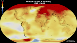
Every day, the livelihoods of millions of people across the Caribbean are threatened by climate change. Whether in the tourism sector, or the fisherfolks out at sea, the loss of flora and fauna due to global warming has an impact on everyone in the region. However, these impacts are becoming more dangerous as the Earth continues to warm. Hurricanes are becoming more intense, droughts more severe, and those with little to no means of survival are much more vulnerable to these threats. Doctor Colin Young, Executive Director of the Caribbean Community Climate Change Center, explains how the climate is affecting the formation of storms.
Dr. Colin Young
Dr. Colin Young, Executive Director, CCCCC
“The same way the world is warming up in terms on land from greenhouse gases. These are your carbon dioxide and methane and other gases that trap the heat that the ocean is also absorbing the heat. And the warmer the ocean gets, the more likely it is that when hurricanes form, that they get stronger quicker. And so the intensity. Is the issue that you saw with burial. And why is this scary? It’s scary because it gives very little time for people to get ready and for the authorities to warn persons to either move out of the part of the stop of the storm or to do the preparations that that you need.”
Young further explains that traditionally, at the start of hurricane season, ocean temperatures reach a peak of around eighty degrees in June, which would not provide enough energy to sustain the formation of a hurricane. However, the past thirteen months have displayed record-breaking temperatures in the Atlantic. At the formation of the season’s most recent hurricane, Beryl, ocean temperatures were on average eighty-four degrees; temperatures that are typically witnessed during September and October. With such high temperatures, the turnaround time between storms becoming major hurricanes is becoming shorter, and more difficult to predict. Michael Taylor, Director of Climate Studies at the University of the West Indies’, in Jamaica, provides additional insight into this dilemma.
Michael Taylor
Michael Taylor, Director, Climate Studies, Mona
“What we don’t have the greatest of science to do right now is predict the rapid intensification, as you have said, so it’s not that we didn’t get a warning that there would be a hurricane, but the amount of time to prepare for this severity of the hurricane now is reduced, and that has a significant impact because it means, you know, the preparations you’d have been doing for a tropical storm or a tropical depression suddenly have to become preparations overnight for a major hurricane.”
Taylor emphasizes the need to adequately prepare for the storms due to this phenomenon. The rapid intensification of storms has occurred in the past, as was witnessed in southern Mexico with Hurricane Otis in 2023. Within twenty-four hours, the tropical storm intensified into a category five hurricane. As was witnessed with Hurricane Beryl, storms are now strengthening to sustain intensity across multiple countries. For poorer communities, this can mean devastation, as they struggle to prepare.
Dr. Colin Young
“The Caribbean is at the frontline of the war on climate change. Our people are suffering the damages and we’re paying in lives and livelihoods from these hurricanes.”
Climate Change is happening now and the most vulnerable are at the forefront of the impacts. At COP27 in 2022, several countries around the world pledged to contribute to the Loss and Damage Fund, which is meant to alleviate the impact of climate change in vulnerable nations, including Small Island Developing States, SIDS. However, that money is yet to be delivered.
Michael Taylor
“Things that we call, used to call urgent, are no longer urgent. There are immediate needs, you know, so things like, okay, we need to mitigate. So we need to decrease the greenhouse gas emissions so that we can keep the future temperature to one point five or, you know, two degrees. That’s no longer something that’s urgent that we should do. We have to do it. And so we. You know, people like me and you, citizens, we have to pay attention now to the cops, and look at what the countries are pledging in terms of their greenhouse gas emissions, including our own countries, and say, boy, we have to do more.”