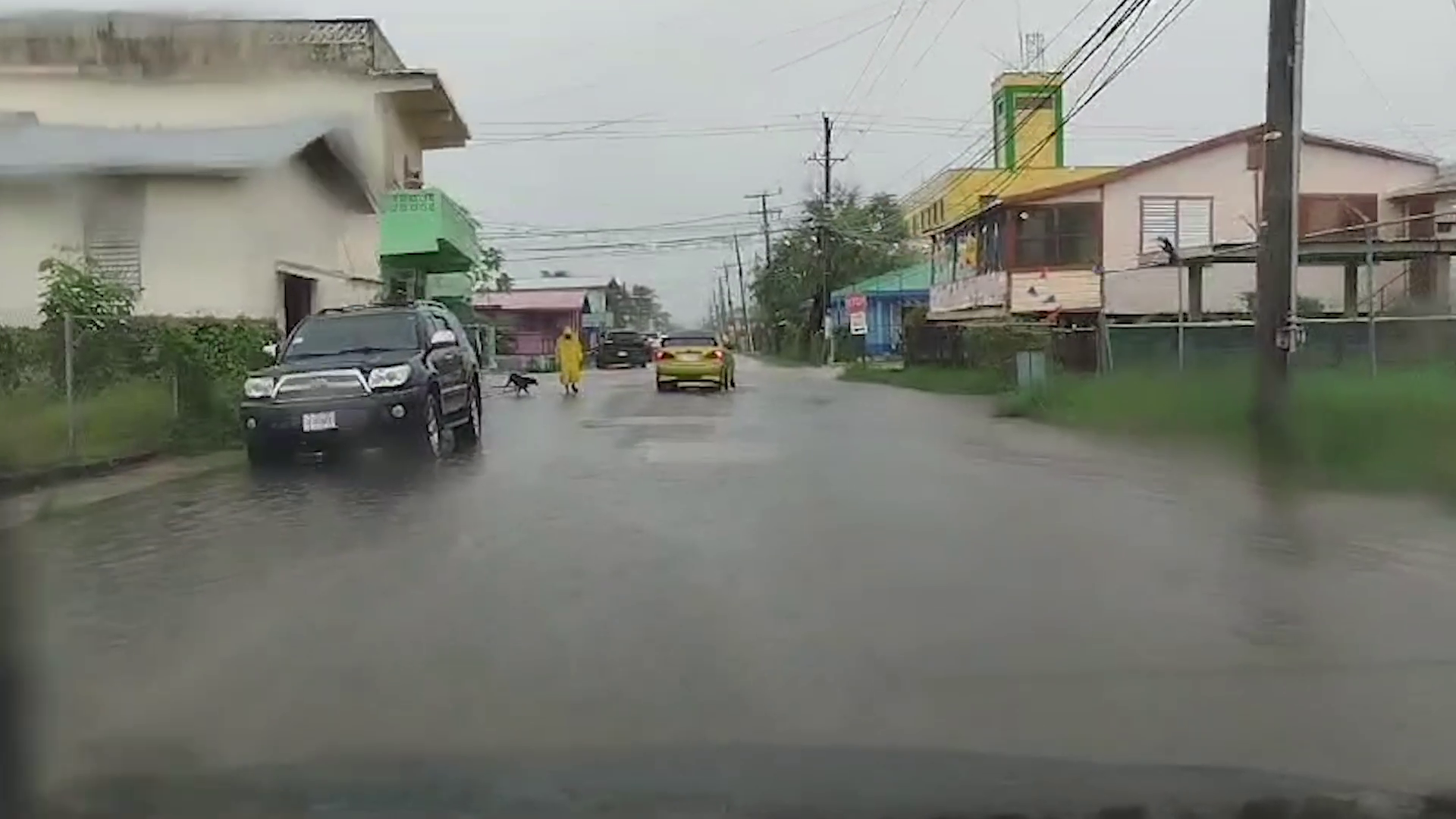
The rain certainly did not stop this week’s mas camp events. Several bands danced under the rainy night skies. They told us that their costumes are durable, and that rain can’t stop the Soca jam. Today, we also sought the opinion of Belize City residents on whether the carnival road march should be postponed. Here is a perspective from one carnival band leader and a resident we spoke with.
David Matus
David Matus, Band Leader, Titans Mas Camp
“As you can see we started off in the rain, because no rain cant stop this jam. So if you are worried about the weather, the weather is not going to stop us. Our customs are durable. You could use it every time, nothing will go wrong with it. So it is durability at its best.”
Kerry Sandoval
Kerry Sandoval, Belize City Resident
“Cho, I feel like deh have to cancel that. I am not into the carnival. I go to church and thing. I am not into the carnival. I not even care. But you cant have carnival on the tenth of September that is what I want to make them know, cause yeah we have to celebrate the tenth and twenty-first. After that year, they could have their carnival and dash out.”
According to the National Met Service, the central and northern areas of Belize received the most rain between nine p.m. on Thursday night and midday today. Belize City received over five inches of rain. The good news is that the showers have decreased. Scattered showers and isolated thunderstorms are expected over the next twelve to eight hours. But the good news is that a general decrease in showers is expected on Saturday.
Shanea Young
Shanea Young, Senior Climatologist, National Meteorological Service
“For the next eight to twelve a few showers, isolated thunderstorms and periods of rain, but mostly over coastal and northern areas tonight and tomorrow morning. And then during the course of the day tomorrow, a general decrease in showers is expected. We can still get up to about two to four inches of rainfall between now and tomorrow morning, and then conditions become a little less moist with showers decreasing over the area.”
Britney Gordon
“ As you mentioned, Belize City is experiencing the most rainfall, we can expect this to persist tomorrow as well? And if so, what areas specifically in Belize City?”
Shanea Young
“The rains and also the showers, Belize City is very small in the Belize District. So it’s the entire Belize District that got the most rainfall. But In terms of the showers, basically, especially the ones that have passed us, they cover the entire city. So both the north and the south side of the city has received around almost the same amount. Slightly less on the southern portions of the city with the areas near Port of Belize and the Coastal getting around one hundred sixty millimeters while on the north side. That was the area that got the 138 millimeters. And so tonight into tomorrow, there is no differentiation between which parts of the city should get at least light rain tonight into tomorrow. But like I mentioned after tomorrow morning, shower activity across the country, not just in the city, should start to decrease. As we go into the weekend.”
Britney Gordon
“So when you say tomorrow morning, around what time do you mean? Because as we know, we have activities very early on in the morning as well. So can we expect heavy rainfall during those as well?”
Shanea Young
“It’s still possible, but not as much. So by the afternoon, it should clear up. By, I would say maybe like by nine o’clock or so tomorrow morning, the significant shower activity should decrease.”
There is going to be a whole lot of rain, accompanied by thunder and lightning insome areas, as a strong tropical wave crosses over Belize starting tonight and for the next day. The weather system entered the Caribbean Sea earlier this week and moved in a northwesterly direction. Chief Meteorologist, Ronald Gordon told the media that Belize is not under any threat of a tropical cyclone watch or warning and that the system has not developed into a tropical depression or a tropical storm. According to Gordon, there is little to no chance of the system becoming anything more than a tropical wave before it gets here, but the amount of rainfall it is expected to produce is significant.
Ronald Gordon
Ronald Gordon, Chief Meteorologist
“In my calculation and based on the forecast models, the axis of this wave will cross the country early tomorrow morning, between midnight and six in the morning. However, the effects of the wave – the rainfall will begin affecting the country from late Thursday evening to tonight, intensifying throughout the night into tomorrow morning. Rainfall model projections are suggesting that for the first twenty-four hours, that is from about this evening into tomorrow evening, we can get up to two to four inches of rainfall with locally higher values from this tropical wave. As the system moves west of the country, we expect rainfall to decrease on Saturday to about one to two inches, then for Sunday, a further decrease. Apart from the very heavy rainfall, intense thunderstorm activity and lightning activity, we can expect it to become very gusty, especially during thunderstorms, leading to very rough sea conditions. So, certainly, apart from the excessive rainfall watch that we have in effect at the moment, which would likely be upgraded to an excessive rainfall warning by this evening, we will certainly issue a caution to mariners to be extremely careful out at sea because we do know that once you get this burst of activity during thunderstorms, you can have very strong winds and rough sea conditions.”
The approaching tropical wave is expected to cause flooding in some parts of the country, according to the Hydrology Department. The department has issued flood alerts for certain areas and has advised residents in flood prone locations to be on the alert for the possibility of flooding and to take necessary action. Chief Hydrologist, Tenielle Hendy updated reporters on areas where they already see rising waters.
Tenielle Hendy, Chief Hydrologist
“We do see the Sibun River reaching bank full stage, and we also are looking at the Mopan River, but based on our 24 hour outlook that we have, there is a caution out to residents in the south of the country, for them to monitor the water level in their area. As well as, you know, we might not be getting rainfall in our country, and it traverses our territorial boundaries. Just remain vigilant and look at the situation in terms of flash flooding. We are seeing some elevated levels in the northern or northeastern part of the country. In terms of the Maskall area, we’re seeing where there’s a lot of water channeling its way in that area, so we put out a flash flood alert and the alert means that flooding is possible to be prepared for the twenty-four-hour outlook. We’re looking at the Rio Hondo, Macall Rivers, all the rivers coming off the Eastern slopes of the Maya Mountains, we see those having elevated levels going into tomorrow morning.”
Because the tropical wave is expected to cause flooding and perhaps damage to older buildings, NEMO will have officers on standby and will be prepared to coordinate the rendering of assistance. NEMO Coordinator, Daniel Mendez also advised that because we are now entering the peak of the hurricane season, it’s important for everyone to have a hurricane plan.
Daniel Mendez
Daniel Mendez, Coordinator, NEMO
“We see the tropics have started to become active. So the time to plan is now you need to have your plan ready. You need to know what to do. So we will continue to stress that for the rest of the season. So, it is really important to have to be aware and to listen to all of the warnings and the briefings that are coming out from the med service and the hydrology. National Hydrology Service as well. Um, as I said, uh, NEMO is on, is on standby as, as, as normal. Uh, we will continue to monitor and be prepared to render any assistance as is required.”
Marion Ali
“The carnival related activities that are planned for tonight going into the weekend – what kind of advisory or advice would you give to these people who have already planned their events for this period of time?”
Ronald Gordon
Ronald Gordon, Chief Meteorologist
“The forecast is indicating that we will have excessive rainfall starting from tonight persisting tomorrow morning, and there’ll be a slight decrease later tomorrow into tomorrow night. However, early Saturday morning, in particular, the forecast indicates that we will have a lot of rainfall. I cannot say for certain if during the event or I don’t know, it will march, so to speak, to the beginning, but we do know that there will be moisture lingering behind waves. It will be west of us by then, and we see moisture lingering behind. So it is really up to the individual and to the, the person preparing these activities to take the necessary action that they would want to take but it will be raining. There is a potential for excessive rainfall tonight and tomorrow. It’s increasing on Saturday. So the good news for the activities on Saturday is that the rainfall will not be as heavy.”
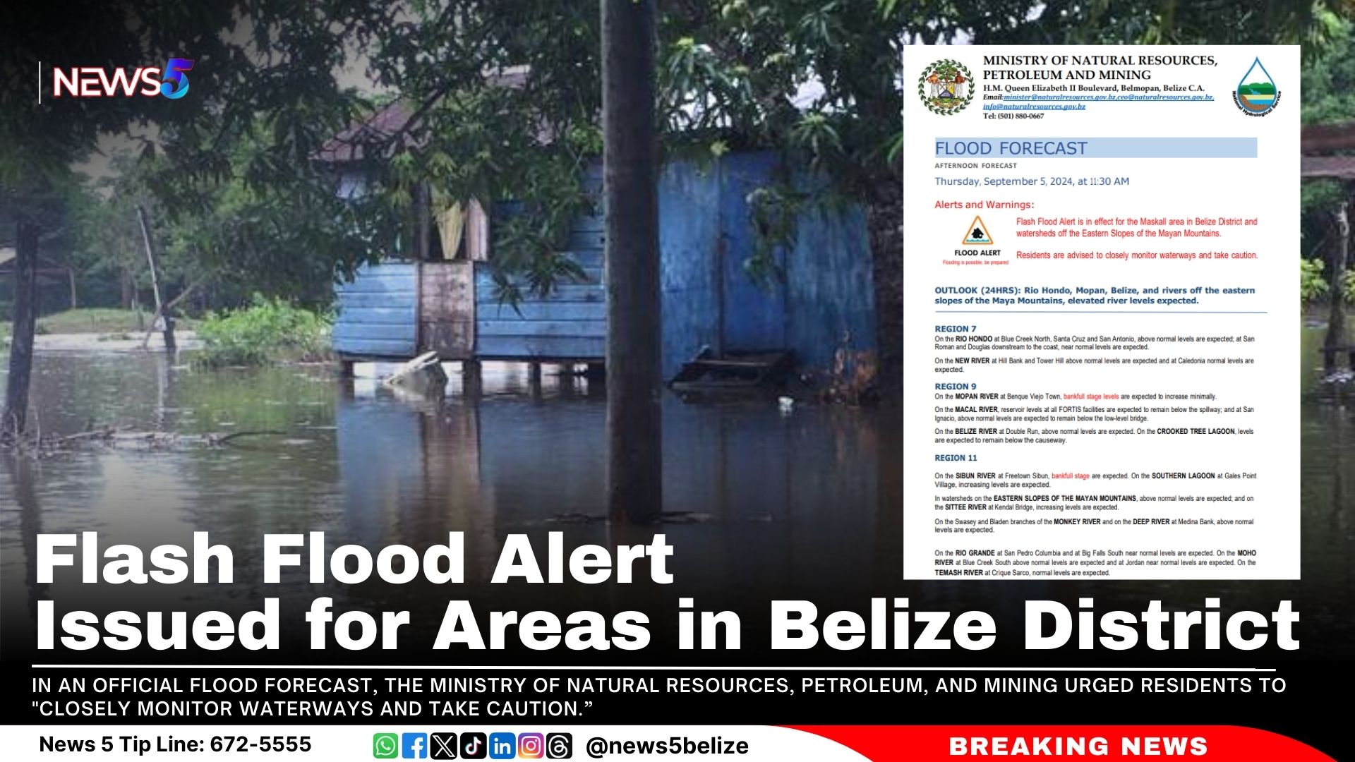
A Flash Flood Alert is now in effect for the Maskall area in Belize District and surrounding watersheds off the Eastern Slopes of the Mayan Mountains. In an official Flood Forecast, the Ministry of Natural Resources, Petroleum, and Mining urged residents to “closely monitor waterways and take caution.”
The Ministry’s Flood Forecast warns of elevated river levels over the next 24 hours. Above-normal levels are expected on the Rio Hondo at Blue Creek North, Santa Cruz, and San Antonio, with near-normal levels downstream at San Roman and Douglas.
Increased levels are expected on the Mopan River at Benque Viejo Town and above normal levels at San Ignacio on the Macal River, though below the low-level bridge. The Belize River at Double Run will have above-normal levels, while Crooked Tree Lagoon levels are expected to stay below the causeway.
The Sibun River at Freetown Sibun will experience bankfull stages and increasing levels on the Southern Lagoon at Gales Point Village. Watersheds on the Eastern Slopes of the Mayan Mountains and rivers like the Sittee, Monkey, and Deep Rivers will also see above-normal levels.
Above-normal levels are anticipated on the Sarstoon River.
Residents in these areas should stay alert for potential flooding.
The first week of Belize’s September festivities unveiled a tantalising preview of Saturday’s Carnival Road March, with Carnival Mas Bands showcasing just a taste of what’s to come. If you think you’ve seen it all, think again. This year’s carnival promises an explosion of vibrant colours, high-energy performances, and extravagant costumes.
However, attendees are advised to prepare for possible rain. Chief Meteorologist Ronald Gordon has reported that a tropical wave is expected to affect Belize. Although Gordon reassured the public that there are no tropical storm or hurricane warnings in effect, he warned of heavy rain and thunderstorms starting tonight: “There is a potential for excessive rainfall tonight and tomorrow. Decreasing on Saturday. So the good news for the activities on Saturday is that the rainfall will not be as heavy,” he stated.
So, hold on to your umbrellas for Belize’s annual carnival experience, rain or shine! Here’s a rundown of more activities for the coming weekend:
Belize City:
September 6: Street Fete at Marion Jones Sporting Complex, 9 PM – PAID
September 7: Carnival J’ouvert, starting at Belcan Bridge and winding through the principal streets of Belize City, 4 AM – FREE
September 7: Carnival Road March, beginning at Memorial Park, proceeding up Marine Parade, onto Barrack Road, then Princess Margaret Drive, and ending at Marion Jones Sporting Complex, 1 PM – FREE
September 8: 5th Martin’s Community Fest at Mahogany Street, 10 AM – FREE
September 8: National Day of Prayer and Ecumenical Service at Fordyce Chapel, SJC, 6 PM
Belmopan:
September 7: Food and Beer Fest at Independence Park, 5 PM
September 8: National Day of Prayer and Ecumenical Service at Independence Plaza, 9 AM
San Ignacio & Santa Elena:
September 6: Senior Citizen’s Day at Octavia Waight Centre, 11 AM
September 8: National Day of Prayer and Ecumenical Service
Benque Viejo:
September 8: National Day of Prayer and Ecumenical Service
Orange Walk:
September 8: National Day of Prayer and Ecumenical Service
Corozal:
September 8: National Day of Prayer and Ecumenical Service
San Pedro:
September 8: National Day of Prayer and Ecumenical Service
Dangriga:
September 8: National Day of Prayer and Ecumenical Service
Punta Gorda:
September 9: Fire Engine Parade through the principal streets of Punta Gorda, 7 PM
As carnival celebrations take place this weekend, the National Meteorological Service of Belize warns of mostly cloudy conditions with outbreaks of showers, thunderstorms, and periods of rain. An excessive rainfall watch is in effect, with potential impacts over the next few days.
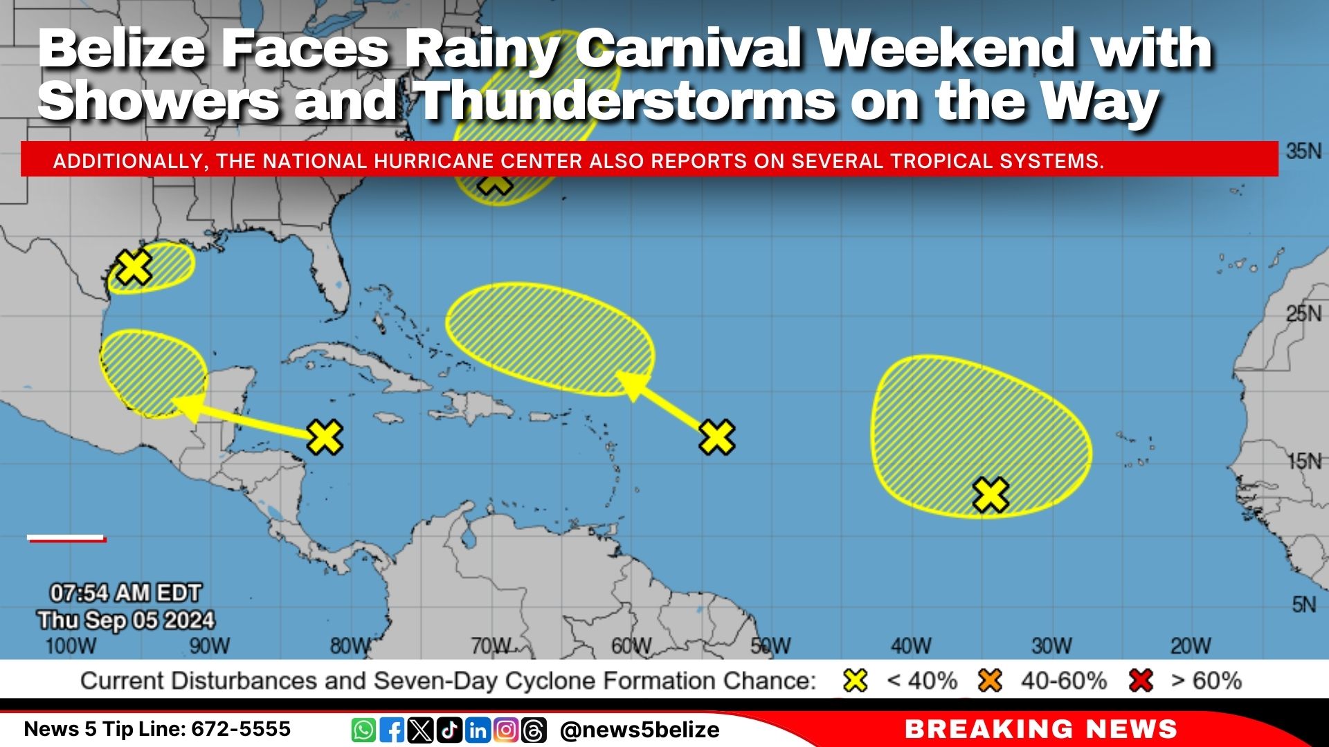
Additionally, the National Hurricane Center also reports on several tropical systems:
Northwest Gulf of Mexico: A trough is bringing widespread disorganised showers and thunderstorms. Heavy rainfall is anticipated along the northern Gulf Coast, with only a 10 percent chance of further development.
Northwestern Atlantic: A low-pressure system east of North Carolina could acquire subtropical characteristics. However, development is unlikely once it encounters cooler waters by late Saturday, with a 20 percent chance of further growth.
Eastern Tropical Atlantic: A broad low-pressure area is producing disorganised activity. Some slow development is possible as it drifts northwest, with a 10 percent chance through the next few days.
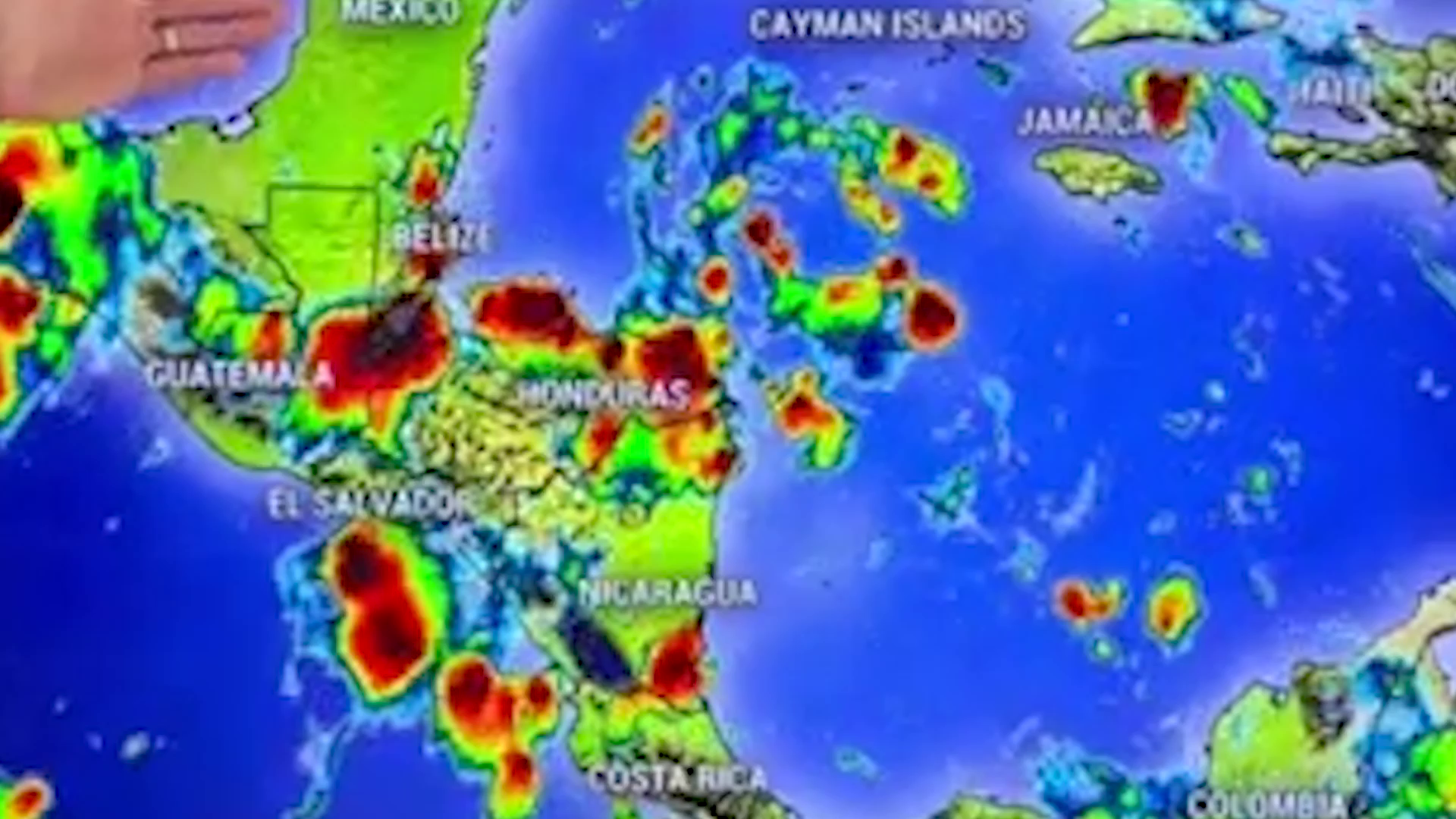
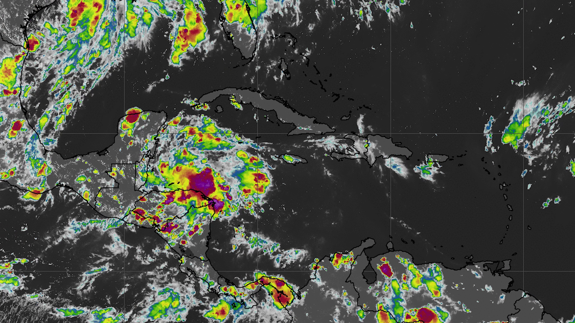
Western Caribbean Sea: A tropical wave is increasing shower and thunderstorm activity. While significant development is unlikely before reaching Belize and the Yucatan Peninsula, there is a 30 percent chance of development once it moves into the southwestern Gulf of Mexico.
The National Meteorological Service of Belize will be hosting a press conference this afternoon to provide updates.
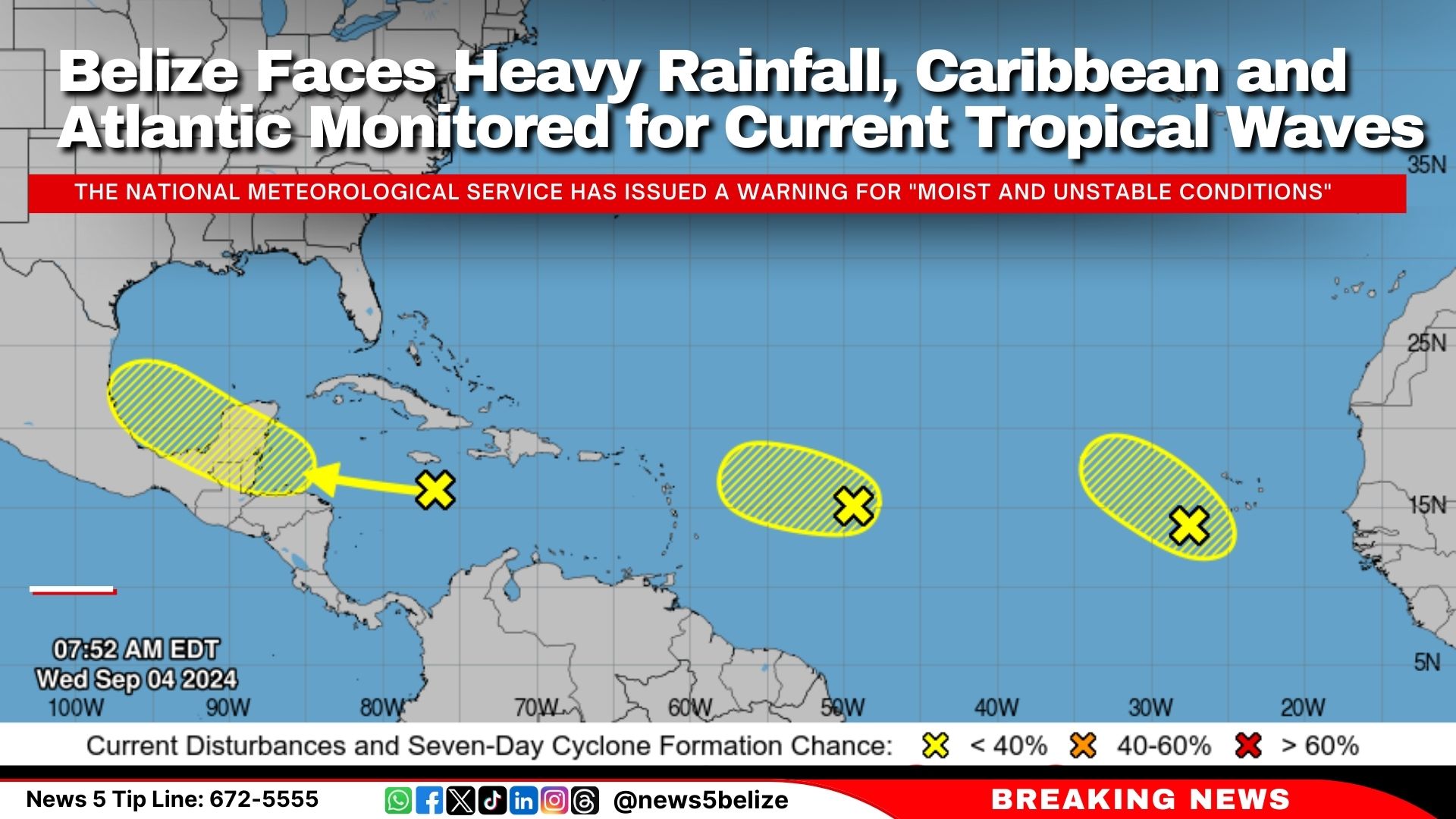
This morning, the National Hurricane Center in Miami reported several tropical waves with low chances of development. A tropical wave moving west at 20 mph is generating “disorganised showers and thunderstorms” near southeastern Cuba and Jamaica, with only a 30 percent chance of formation over the next week. Another wave, east of the Lesser Antilles, is showing minimal activity and has a 10 percent chance of significant development. A third wave in the eastern Atlantic is also producing disorganised showers, with a 20 percent chance of slow development in the coming week.
In Belize, the National Meteorological Service has issued a warning for “moist and unstable conditions” expected to continue over the next few days. The 24-hour forecast indicates “mostly cloudy to overcast skies,” with “a few showers, thunderstorms, and periods of rain” impacting northern and central areas today, with increased activity anticipated tonight, especially over the south and coast.
An excessive rainfall watch is in effect due to the potential for heavy rainfall, and small craft operators are advised to exercise caution due to gusty winds and rough seas.
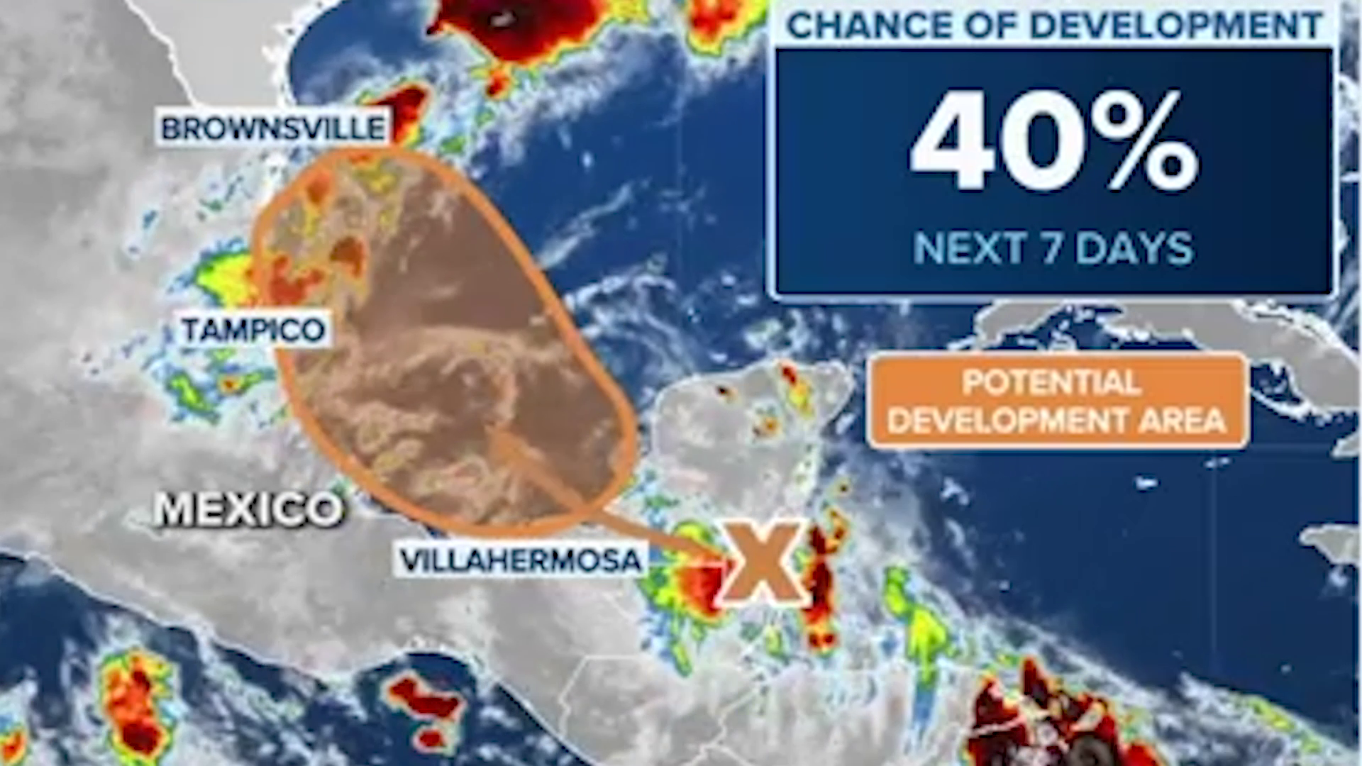
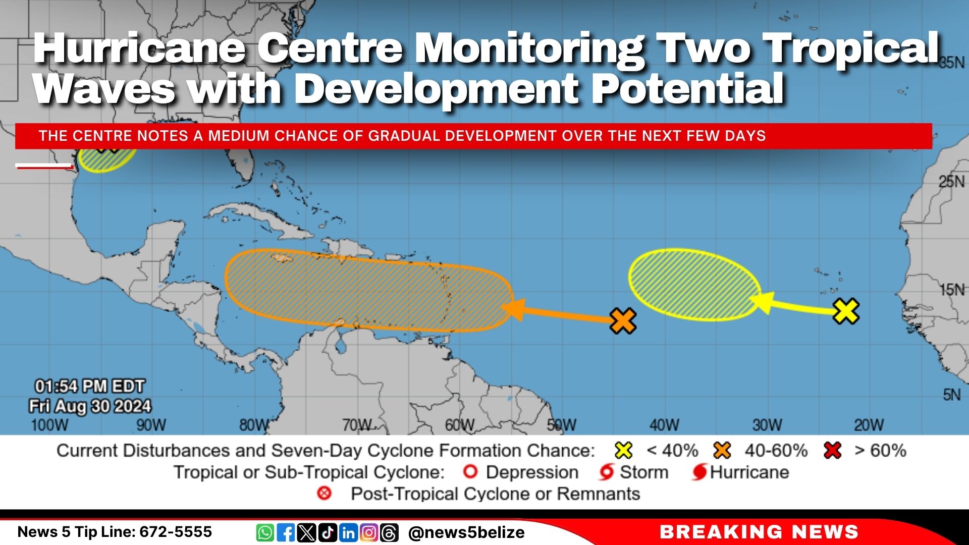
The National Hurricane Center released its latest tropical weather update this afternoon, highlighting two systems under observation. The first, a tropical wave over the central tropical Atlantic, is associated with showers and thunderstorms but remains disorganised. The Centre notes a medium chance of gradual development over the next few days, with a potential to become a tropical depression next week as it moves westward across the Caribbean Sea. Currently, the formation chance through 48 hours is near 0 percent, but increases to 40 percent over the next seven days.
Additionally, another tropical wave near the Cabo Verde Islands is being monitored. Although it is producing minimal activity, some slow development is possible as it progresses west-northwest over the eastern and central tropical Atlantic. The formation chance through 48 hours is near 0 percent and rises to 20 percent through 7 days.