Early Threat of First 2024 Hurricane to Caribbean

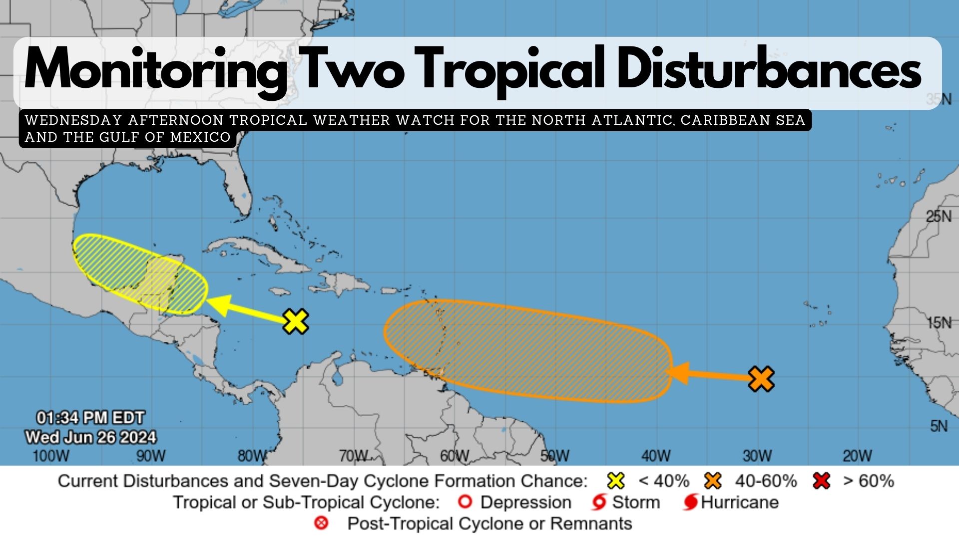
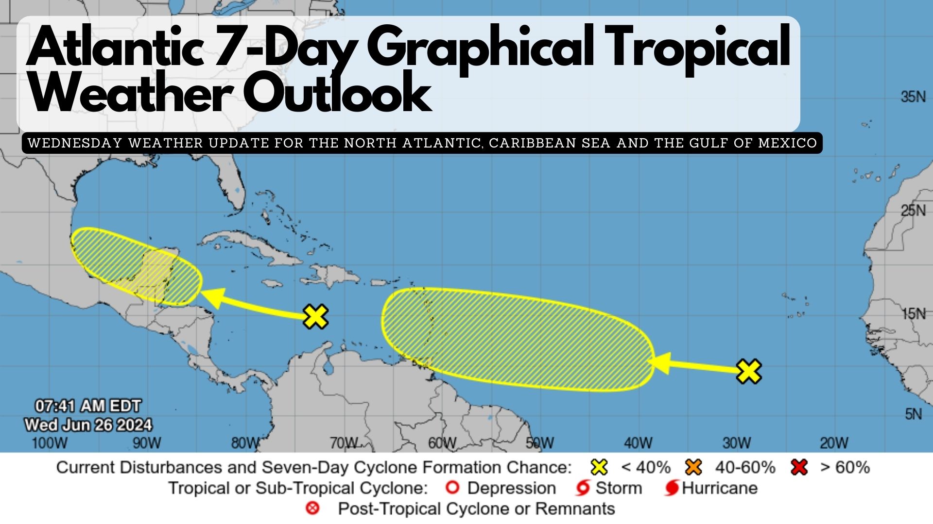
AccuWeather is reporting that early activity in the tropical Atlantic suggests the potential formation of a tropical storm or hurricane, posing a threat to the Caribbean. A narrow plume of moisture extending from the south-central Atlantic to the Caribbean Sea could aid in the system’s development and intensification.

AccuWeather began labeling this system as a tropical rainstorm on Thursday to heighten awareness of its potential hazards to life and property.

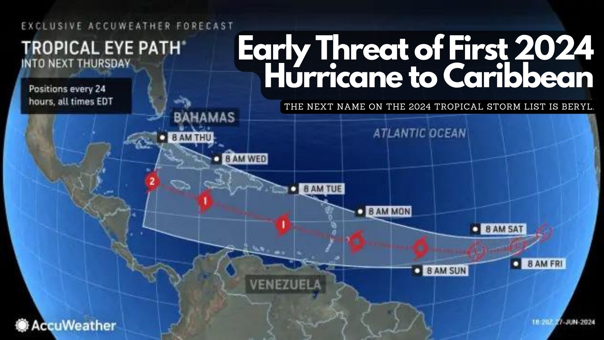
Forecasters anticipate the system to strengthen to at least tropical storm intensity as it nears the Windward Islands, likely bringing squally rains, gusty thunderstorms, and rough seas as early as Sunday. There’s a possibility it could reach Category 1 hurricane status (sustained winds of 74-95 mph) upon approaching the Windward Islands.

The next name on the 2024 tropical storm list is Beryl.

Depending on steering currents, the system may track westward across Central America next week or turn northwestward towards the western Gulf of Mexico by the following weekend, potentially threatening the United States.

In another part of the Atlantic, a separate tropical wave is approaching Central America, with a moderate chance of developing into a tropical depression before moving into east-central Mexico on Sunday.

If another system develops in the coming days or weeks, it would be named Chris, according to the 2024 tropical storm list.

Monitoring Two Tropical Disturbances 

(2 p.m. update) Meteorologists from the National Hurricane Center in Miami are closely monitoring two disturbances that could potentially develop into tropical cyclones.

Western Caribbean/Southwestern Gulf of Mexico:
The first disturbance is currently a tropical wave sweeping through the central Caribbean Sea at a brisk pace of twenty-five miles per hour. While shower activity remains disorganised, conditions are expected to become more favourable for gradual development over the weekend. There is a possibility that this system could intensify over the western Caribbean Sea or the southwestern Gulf of Mexico.
* Formation chance through 48 hours…low…10 percent.
* Formation chance through 7 days…low…20 percent.

Eastern Tropical Atlantic:
Meanwhile, a second tropical wave located southwest of the Cabo Verde Islands is also under scrutiny. This system is generating scattered showers and thunderstorms and has the potential to strengthen over the next few days. Forecasters indicate that a tropical depression could potentially form in the eastern tropical Atlantic by the end of the week or into the weekend as it moves westward at 15 to 20 mph.
* Formation chance through 48 hours…low…near 10 percent.
* Formation chance through 7 days…medium…40 percent.

Atlantic 7-Day Graphical Tropical Weather Outlook

As of 8:00 AM EDT on Wednesday, June 26, 2024, the National Hurricane Center in Miami, Florida, has identified two areas of interest in the Atlantic basin that could potentially develop into tropical systems over the coming days.

Western Caribbean/Southwestern Gulf of Mexico:
The first area of concern is a tropical wave currently situated over the central Caribbean Sea. This system is moving rapidly westward at approximately 25 mph, accompanied by disorganised shower activity. There is a possibility that environmental factors may improve by the weekend.
* Formation chance through 48 hours…low…10 percent.
* Formation chance through 7 days…low…20 percent.

Eastern Tropical Atlantic:
The second area being monitored is a tropical wave located several hundred miles southwest of the Cabo Verde Islands. This disturbance is generating disorganised showers and thunderstorms as it moves westward across the central and western tropical Atlantic at a speed of 15 to 20 mph.
* Formation chance through 48 hours…low…near 0 percent.
* Formation chance through 7 days…low…30 percent.

Exit mobile version