


Planning for Sustainability in Belizean Waters
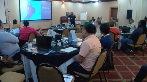
This morning, the Coastal Zone Management Authority and Institute hosted its second Belize Sustainable Ocean Plan Geo-Spatial workshop. This three-day event gathers stakeholders to discuss priority ocean protection areas using specific data collection tools. It is a continuation of the Multi-sector Marine Spatial Planning Workshop hosted in 2024. News Five’s Britey Gordon has more details on the event.
 Britney Gordon, Reporting
Belize’s ocean space is crucial for the survival of many sectors, including tourism, fishing, and conservation. Protecting these shared waters is essential. Today, the Coastal Zone Management Authority and Institute started a geospatial workshop to help stakeholders identify priority areas for protection and understand how ocean space is used.
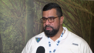
Samir Rosado
Samir Rosado, MSP Lead, CZMAI
“The purpose of the workshop is to look at the use and application of two decision support tools that we’re using in our MSP development process. The two tools that we’re looking at are namely Sea Sketch and Marxan. Now Sea Sketch is more of a data collection tool as well as a planning tool so it’s multifaceted. Sea Sketch is what we’re utilizing to capture information from the general public, from users of our ocean space to figure out exactly where our priority areas are for the various usages.”
The team wants to make sure that areas used for recreation and religious activities are included in the data collection, so people aren’t displaced. Data collection tools are crucial for this. At the workshop, there’s a team from the University of California, Santa Barbara, who developed the Sea Sketch Application. Senior Fellow Will McClintock explains how it works.

Will McClintock
Will McClintock, National Center for Ecological Analysis & Synthesis, UC Santa Barbara
“It’s a tool that allows users who can be non-technical users, average stakeholders with no real expertise in, in mapping to map their values in terms of what areas in the ocean they value and how they use it, and then what areas they would like to protect and protected areas or biodiversity protection zones. So my team is here to teach folks how to use this tool and ultimately design biodiversity protection zones that are meeting science and policy guidelines for ecosystem protection while minimizing the displacement of users of ocean space.”
Sea Sketch is accessible to anyone with internet access and lets users add data to a map, showing popular areas and their uses. Another tool at the workshop is Marxan, which helps with marine spatial planning. Kate Longley-Wood, Marine Spatial Planning Science Manager at The Nature Conservancy, explains that the team is figuring out how to integrate the collected data into their technical tools.
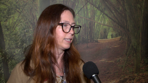
Kate Longley-Wood
Kate Longley-Wood, Marines Spatial Planning Science Manager, T.N.C.
“Marxan is a tool that lets users put in information about priorities for conservation. So Marxan can let users say, okay, I want a marine protected area network that represents. It’s thirty percent of coral reefs and maybe also integrates other stakeholder concerns, like avoiding areas that might have high levels of conflict or high levels of cost. And so this program is really good at taking really complex criteria and turning it into outputs that people can then understand and comment on. And so it’s a really great process that is used for Marie spatial planning processes around the world.”
 Marxan can be used to provide potential solutions to complex conservation questions, such as where a country should place a marine protected area. It also works alongside tools such as Sea Sketch to generate input data results. Rosado explains that by continuing work such as this, Belize is on its way to meeting the thirty percent ocean space as biodiversity protection zone goal.
Samir Rosado
“That thirty percent goal is tied to two milestones that are time-bound deliverables under the blue bond agreement. Recently in November fourth of last year, we met the milestone four goal, which is to designate twenty-five percent of Belize’s ocean space as a biodiversity protection zone. So that was met in November of last year. So we are currently at twenty point zero five percent of our ocean space designated the remainder of the timeframe, or I should say the next milestone is due for November fourth of next year. And so we are working towards identifying and designating the remaining up to forty percent.”
Britney Gordon For News Five.
Facebook Comments