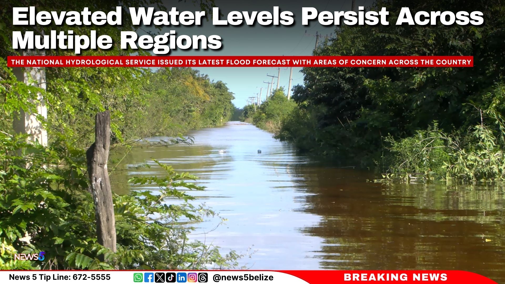
The National Hydrological Service issued its latest flood forecast with areas of concern across the country. In Region 7, residents are advised to monitor waterways closely. The Rio Hondo is expected to reach bankfull stage at Blue Creek North, while decreasing flood levels are forecasted for Santa Cruz, San Antonio, San Roman, and Douglas to the coast. Along the New River, above-normal water levels are expected to persist from Hill Bank to Caledonia and the coast.
In Region 9, residents should exercise extreme caution. On the Mopan River at Benque Viejo Town, water levels are expected to decrease from bankfull stage, while on the Macal River, levels at all FORTIS facilities are projected to remain below the spillway, with San Ignacio staying below the low-lying bridge. The Belize River is expected to see a reduction in flood levels at More Tomorrow, but historical Hurricane Mitch flood levels will persist at Double Run. Crooked Tree Lagoon remains steady with water levels above the causeway.
In Region 11, above-normal levels are expected to continue along the Sibun River at Freetown Sibun and the Southern Lagoon at Gales Point Village. Elevated levels are forecasted for the eastern slopes of the Maya Mountains and the Sittee River near Kendal Bridge, while the Monkey River’s Swasey and Bladen branches, as well as the Deep River near Medina Bank, are projected to remain below normal. The Rio Grande at San Pedro Columbia and Big Falls South is expected to maintain normal levels, while the Moho River near Blue Creek South and Jordan will see above-normal levels. The Temash River at Crique Sarco is anticipated to remain at normal levels.
Finally, in Region 13, the Sarstoon River is expected to maintain normal water levels. Residents across all affected areas are urged to remain cautious and monitor updates as conditions evolve.
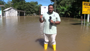
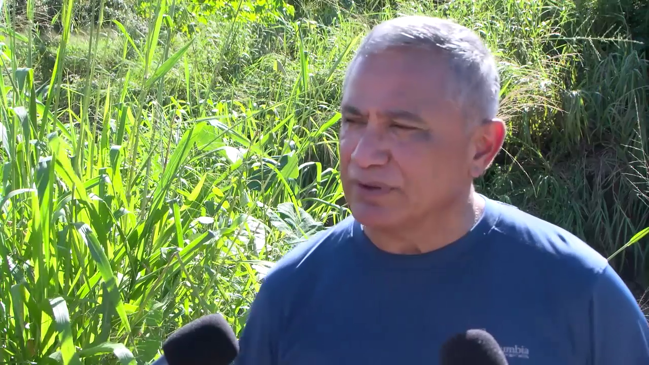
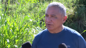
Earlier today, the National Emergency Management Organization (NEMO) shared an update on all the roads that are currently impassable due to flooding. For almost two weeks now, folks in northern and western Belize have been dealing with the aftermath of Tropical Storm Sara. As the floodwaters travel down the Belize River, communities in rural and central areas are now experiencing rapid flooding. With water levels changing daily, we caught up with Nicole Zetina, the Public Relations Officer for the Ministry of Disaster Risk Management, to get the latest scoop on the affected areas.
Nicole Zetina
Nicole Zetina, Public Relations Officer, Disaster Risk Management “I will start with the Orange Walk District. So we have in the San Antonio Village, the main access road for that is accessible, but not for heavy duty trucks. So with there’s still water in the road. So we’re asking heavy duty trucks, you know, the big loaders and the dump trucks, not to pass by because with that weight, it will only make it worse. San Estevan, the ferry is closed. As everything that is closed or impassable is still underwater. For the Belize District, we have Burrell Boom, the main access road is impassable for small vehicles. And the road leading to the police station is also impassable for small vehicles. And that means anything that is very low. So if you have an SUV or a four-seater truck that’s a bit higher, that is possible for you for a smaller car. We’re not advising that you pass because the water level is, is high that it will cause some damage to your vehicle or for you not to even be able to cross the road. Grace Bank, the main access road is impossible. Crooked Tree, main access road is also impassible for Lucky Strike. Free Town Sibun, both impassible for small vehicles. May Pen, completely impassible. We have Flowers Bank, Bomba, Rancho Dolores, and the Sunset Park Western Paradise Community, all impassable for small vehicles. In the Cayo District, the San Ignacio Town, the low-lying bridge, is closed. Central Farm Baking Pot Ferry is closed. The Black Man Eddy is closed. Iguana Creek Bridge is now open. The San Jose Succutz Village is closed. So that’s the Xunantunich Ferry. And yeah, that’s about it for today. Every day in the morning, we try to, as early as possible as we get the information, and this is in conjunction with the MIDH, we try to post out this information so that our traversers know to proceed with caution. So we give a daily update as we get this information.“
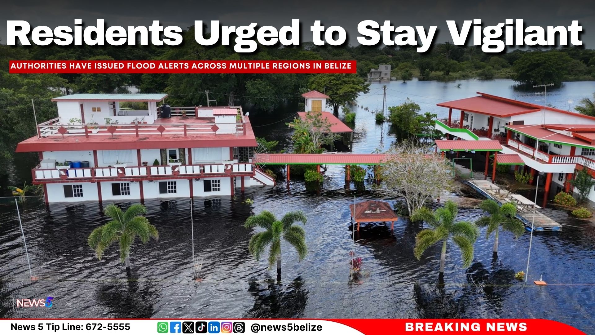
Authorities have issued flood alerts across multiple regions in Belize, advising residents to monitor waterways closely and exercise caution as water levels fluctuate.
Residents in Region 7 are cautioned to be vigilant, especially near waterways. On the Rio Hondo, decreasing flood stage levels are anticipated at Blue Creek North, while increasing flood levels are expected at Santa Cruz, San Antonio, San Roman, and Douglas to the coast. Along the New River, bankfull stage levels are forecasted at Hill Bank, Tower Hill, and Caledonia to the coast.
In Region 9, extreme caution is advised as flood stage levels continue along the Mopan River at Benque Viejo Town. On the Macal River, reservoir spillways at Chalillo, Mollejon, and Vaca remain active, though water levels at San Ignacio are expected to stay below the low-lying bridge. The Belize River is experiencing varying trends, with flood levels decreasing at More Tomorrow but increasing at Double Run, where levels are nearing historical Tropical Depression 16 (TD16) marks. At Crooked Tree Lagoon, water levels have surpassed the causeway and continue to rise.
Region 11 residents should remain alert as above-normal water levels are reported at Freetown Sibun on the Sibun River and at Gales Point Village on the Southern Lagoon. On the eastern slopes of the Maya Mountains and the Sittee River near Kendal Bridge, above-normal levels are expected to persist. Meanwhile, below-normal levels are noted on the Monkey River branches at Swasey and Bladen, as well as the Deep River at Medina Bank.
Rising levels on the Rio Grande at San Pedro Columbia and Big Falls South are expected to decrease. However, above-normal levels persist on the Moho River at Blue Creek South and Jordan. The Temash River at Crique Sarco is experiencing below-normal levels.
On the Sarstoon River, above-normal levels continue to pose concerns.
Residents in affected areas are urged to monitor official updates and adhere to safety measures as authorities continue to assess the situation.
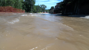
A flood warning remains in effect for rivers and tributaries across the northern, central, and southern regions of Belize, including the Rio Hondo, Mopan River, Sittee River, and rivers along the eastern slopes of the Maya Mountains. Severe flooding persists along the Belize River and its tributaries, affecting communities in the Belize River Valley and downstream areas. The San Ignacio Low-Lying Bridge and Iguana Creek Bridge remain closed, while the Crooked Tree Causeway is impassable due to rising water levels. Residents in affected areas are urged to exercise caution and stay informed of further updates.
Residents in Region 7 are advised to monitor waterways and exercise caution. On the Rio Hondo, flood stage levels are expected to increase at Blue Creek North, Santa Cruz, and San Antonio, while persistent flooding is anticipated from San Roman and Douglas to the coast. Similarly, the New River is expected to reach bankfull stages at Hill Bank, Tower Hill, and Caledonia to the coast.
In Region 9, residents are urged to exercise extreme caution. The Mopan River at Benque Viejo Town is predicted to maintain flood stage levels. On the Macal River, reservoir levels at the Chalillo, Mollejon, and Vaca spillways remain active, though flood levels at San Ignacio are expected to decrease. The Belize River at More Tomorrow is also seeing a reduction in flood levels, but rising flood stages are anticipated at Double Run. Meanwhile, water levels in the Crooked Tree Lagoon have exceeded the causeway and continue to rise.
Region 11 residents should stay vigilant near waterways. On the Sibun River at Freetown Sibun, flood levels are decreasing, while above-normal levels persist at the Southern Lagoon in Gales Point Village. Watersheds on the eastern slopes of the Maya Mountains and the Sittee River at Kendal Bridge are expected to remain above normal levels. Flooding is anticipated along branches of the Monkey River, particularly at Swasey and Bladen. The Deep River at Medina Bank is maintaining normal levels, but above-normal levels are expected at the Rio Grande near San Pedro Columbia and Big Falls South. The Moho River at Blue Creek South and Jordan, as well as the Temash River at Crique Sarco, are also expected to maintain above-normal water levels.
In Region 13, above-normal water levels are expected along the Sarstoon River.
Residents are advised to monitor waterways and exercise caution or extreme caution, depending on the region, as flood conditions persist across several areas.
In Region 7, increasing flood stage levels are expected on the Rio Hondo at Blue Creek North and at Santa Cruz, San Antonio, San Roman, and Douglas to the coast. On the New River, bankfull stage levels are anticipated at Hill Bank, Tower Hill, and Caledonia to the coast.
In Region 9, extreme caution is urged. On the Mopan River at Benque Viejo Town, flood stage levels are expected to continue. On the Macal River, the Chalillo, Mollejon, and Vaca spillways remain active at the Fortis facilities, while flood levels at San Ignacio are decreasing. On the Belize River, flood levels are dropping at More Tomorrow but rising at Double Run. In Crooked Tree Lagoon, water levels have exceeded the causeway and continue to rise.
In Region 11, flood stage levels are decreasing on the Sibun River at Freetown Sibun. However, above-normal levels are observed on the Southern Lagoon near Gales Point Village. On the eastern slopes of the Maya Mountains and the Sittee River at Kendal Bridge, above-normal levels persist. Flood stage levels are expected on the branches of the Monkey River at Swasey and Bladen, while normal levels are reported on the Deep River at Medina Bank. Above-normal levels are expected on the Rio Grande at San Pedro Columbia and Big Falls South, the Moho River at Blue Creek South and Jordan, and the Temash River at Crique Sarco.
In Region 13, above-normal levels are expected on the Sarstoon River.
Residents are encouraged to stay informed and exercise appropriate precautions.
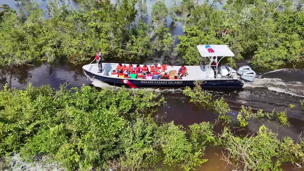
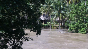
A week has passed, but the country is still reeling from the impact of Tropical Storm Lisa. The storm swept rapidly across Belize, but even before it made landfall, it unleashed heavy rains that caused rivers to overflow. Neighboring Honduras bore the brunt of the storm, recording forty inches of rain in just three days, while Guatemala also faced significant downpours. News Five has been tracking the floodwaters, starting in western Belize on Monday and now in Crooked Tree by week’s end. Yesterday, the road into the village became impassable, and today, the only way in or out is by boat. At least twelve families have had to evacuate as floodwaters continue to rise around the village. News Five’s Paul Lopez traveled there today and filed this report.
Paul Lopez
Paul Lopez, Reporting
I am currently standing at the entrance to Crooked Tree Village waiting for a boat to take us in. We got here and initially attempted to enter the village by way of a pickup truck. However, the road is impassable at this point in time by any sort of vehicle. This is the second day the roadway has been inundated by flood waters and this is the reality that residents now have to face to get to and from the community. Earlier today, a Belize Defense Force truck managed to navigate the flooded road into the village. However, when another truck arrived later with groceries for the residents, it didn’t dare attempt the same route. Sheril Adolphus took a boat from the village at dawn to run her breakfast restaurant in Sand Hill. We caught up with her as she waited for the midday boat to take her back home.
Sheril Adolphus
Sheril Adolphus, Resident, Crooked Tree
“Ih just punishing that you have to catch the boat off and on and then you have a lot of load. So, it is very stressful, it is very tiring, very uncomfortable. I mih the do a business in Sand Hill, do breakfast in the morning. But, I cannot cross the water everyday four o’clock to go and work.”
The grocery supplies that arrived today are very much needed, because the flooded roadway has prevented grocery store suppliers from entering the community.
Kenisha Garbutt
Kenisha Garbutt, Vice-Chair, RSMC NEMO
“Today we are out here to stock the shelter and give a predisposition into the community. We are heading into Rancho and Lemonal when we are done from here and then we are doing a quick stop in Boom just to ensure the shelters are stocked in the event that it needs to be opened.”
Paul Lopez
“Currently this is the only way in and out of Crooked Tree Village. Quite honestly it is a bit stressful in and out these boats. Earlier one Coast Guard boat came in to pick up passengers from a bus. But, the amount of residents that came on that boat required the Coast Guard to call for additional boats. Then, you have the supplies that must go in as well. So, this is what Crooked Tree residents are dealing with and perhaps for days if not weeks to come.”
A makeshift peer has been constructed at the village’s entrance for boats to dock. There, we met with the village Chairman, George Tillett. He shared with us how the floodwaters have affected his community.
George Tillett
George Tillett, Chairman, Crooked Tree
“We have been affected very rashly, because it has affected normal life, especially for the commuters, for students. We have something like eighty students who commute daily for high school and sixth form. Last night, the last boat came in somewhere like ten o’clock. Some of the students and workers got frustrated and they end up walking that one mile of water across the lagoon. I think I counted some twenty-three people that walked across the water last night, because they were there from around five o’clock in the evening. There was only one boat that can only take twenty people. And imagine there is a hundred and eighty people out there waiting with one boat that can only take twenty people with an interval of thirty minutes per trip.”
It’s not just commuters who are facing challenges. Fisherfolk can’t head out to work because of the floodwaters, leaving their boats docked. The Birds Eye View Resort is completely underwater, forcing the owners to evacuate their guests. According to Tillett, cattle farmers in the community are now required to travel three miles over water to get to their livestock. In the face of all these challenges, one teacher from Belize City is braving the floodwaters to educate children in the community.
Paul Lopez
“Why did you still decide to come to work today?
Vanessa Allen
Vanessa Allen, Teacher
“Well apart from it being my passion to teach. I want to still be here for my children. Well, it is my job. So, I find it very, it is not really challenging for me, because I need to be here for my kids I still make the effort to come.”
Paul Lopez
“Do you do it again all over on Monday?”
Vanessa Allen
“Well, on Monday if I have to, I will make it.”
Violet Moulten, a resident of Crooked Tree, has evacuated her home to seek shelter in a nearby church. She says this is the seventh time over the course of her life that she has had to leave her home due to flooding.
Violet Moulten
Violet Moulten, Resident, Crooked Tree
“All kinda trauma we guh through with this thing. The most thing dah the kids and the water. I have to lock up the house all the time because I don’t want them to go to the water.”
Paul Lopez
“Why haven’t you moved or relocated yourself and your family?”
Violet Moulten
“No way, I will never trade my place for nowhere, because I have been to America and I see nowhere like Crooked Tree.”
According to George Tillett, the Chairman of Crooked Tree Village, flooding has become a more frequent issue in the community. He recalls that when he was growing up, the lagoon would flood about once every ten years. Now, he’s noticed it overflowing every four to five years. Tillett has proposed a solution that some might find unconventional: building a spillway from the lagoon to the New River to help mitigate the flooding.
George Tillett
George Tillett, Chairman, Crooked Tree
“You ask about long term solution, well I have made a proposal to the government, because the Crooked Tree Lagoon is a basin for all the water coming up from Cayo, Guatemala, Benque and the solution is, we did a fly over in the peek of the flooding season one year ago and we found out that the New River is below us. It is only like two miles away from our water body. So, my solution to them is if they would dig a channel, like an overspill, probably about four feet deep, twenty feet wide, all the way to New River, then our land, our roads, wouldn’t be flooded, because whenever it reaches a certain level it would empty out into the New River, which will alleviate our flooding and pump fresh waters into the stagnant waters of New River.”
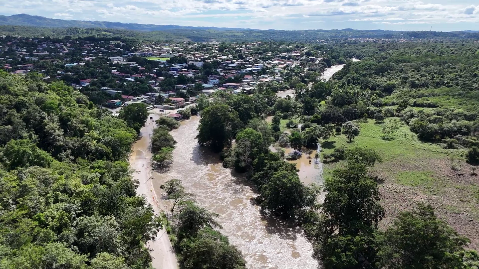
The Mopan River started rising rapidly this morning after being flooded for the past three days. Tropical Storm Sara dumped over forty inches of rain in neighboring countries, and all that water is now flowing through the river system into Belize. Today, the Mopan River overflowed its banks and spilled onto the highway in San Jose Succotz, forcing authorities to close part of the road to motorists. Residents in the village and in Benque Viejo Town remember the river rising even higher back in 2020, but this is the worst it’s been since then. Tonight, there’s a lot of uncertainty about when the floodwaters will recede, and life will return to normal. News Five’s Paul Lopez reports.
Paul Lopez, Reporting
This morning, the Mopan River, which flows through Benque Viejo Town and San Jose Succotz, started rising quickly. By mid-morning, two sections of the highway in Succotz were submerged under a couple feet of water. Local authorities had no choice but to close the road. All this flooding is the result of water flowing in from neighboring countries after Tropical Storm Sara. It is just before midday in San Jose Succotz and over night the Mopan River has risen to heights that have overtaken a portion of the highway in the village. This portion of the highway leads through the village into the Benque Veijo Del Carmen Town. This is one portion of the highway where we are currently standing that authorities in the community have decided to close. Today, residents were out in force, watching as the river continued to swell and flood the highway. We spoke with one villager who has been keeping a close eye on the rising waters over the past few days.”
Voice of: Succotz Resident
Voice of: Succotz Resident
“Yesterday we came down and there were no water on the streets on the road. This morning when we came down I saw motorcycles going and people walking. But, it was not coming up to there. It was only where you see the yellow ban. Up to there was the river, now I see it much deeper. It is raising more. It is very alarming because we are trapped here we can’t go out.”
Despite the road closure, some residents were wading through the floodwaters. One person even took the opportunity to swim in the flooded drain, while others rode by on bicycles. At the village entrance along the river, a store owner was busy evacuating as the floodwaters had already started to seep into her shop.
Janet Dart
Janet Dart, Store Owner
“Last night I mih the eena my bed and my husband that is all the way in Colorado called me and tell me ih the watch the news from Melchor and the river the rise and mek I come deal with everything. So I reach here about seven, lee bit before seven and the water mih deh way over that side, just mih the start come in, but now. Good thing they come tek the stuff out. So, we nuh really the build much worries, other than the mud cleaning afterwards.”
Paul Lopez
Paul Lopez
“We are now at the second portion of the road that is closed just outside of San Jose Succotz. This is the entrance to Benque Viejo Del Carmen Town. And If you look behind me there is a bridge that connects Benque to San Jose Succotz. That is completely inundated by water. As a result, authorities had to close it. And again the only way to get to Benque is through that detour that we took moments ago.”
The detour winds through the hills of San Jose Succotz, taking a less-traveled path. It’s far from ideal, with some rough patches along the way, but it served its purpose. Benque Viejo Mayor Jorge Rosales was on-site, overseeing the much-needed road repairs along the bypass.
Jorge Rosales
Jorge Rosales, Mayor, Benque
“Seeing this we have to may sure the bypass is open. The road going down here is very deteriorated, because everything is rock is hard to fix. But we kind of made it easy to go down and not to come up. By the east side here by Vegas house we fix the next road which will be getting ou from Benque going into Succotz and this one goes into Benque. At the same time the truck coming from Guatemala are not able to come through, nor the buses like Fronte Del Norte they are not coming in..”
With the main road closed and large trucks and buses barred from using the detour, several tourists traveling by bus through the Belize-Guatemala border found themselves stranded with little to no information. We spoke with one tourist from Denmark who was on his way to Caye Caulker.
Clara Lendqvist
Clara Lendqvist, Tourist
“We learnt a little bit about the bad weather and the hurricane and stuff like that. But we didn’t think it would be this hard to get into Belize. We are going to Caye Caulker so we also need to get the ferry.”
Paul Lopez
“So what’s the update for you all right now?”
Clara Lendqvist
“Right now we are in a little waiting position. Four of our friends went to get some cash and hopefully we could get a taxi.”
In the heart of Benque, Benedict Palacio has been sitting on his back porch for the past few days watching the Mopan River rise. Being so close to the river usually offers stunning views when the water levels are normal. But on days like these, it’s a whole different story.
Benedict Palacio
Benedict Palacio, Benque Viejo Town Resident
“We have done our mitigation. We have put our sandbag there, because we believe if it gets worst than this we have our basement downstairs and we wouldn’t want that to be flooded out. That would be the worst-case scenario for us. But I don’t think that will happen. I don’t think it will get worst than this. At least that is what I am praying for and keeping my fingers crossed.”
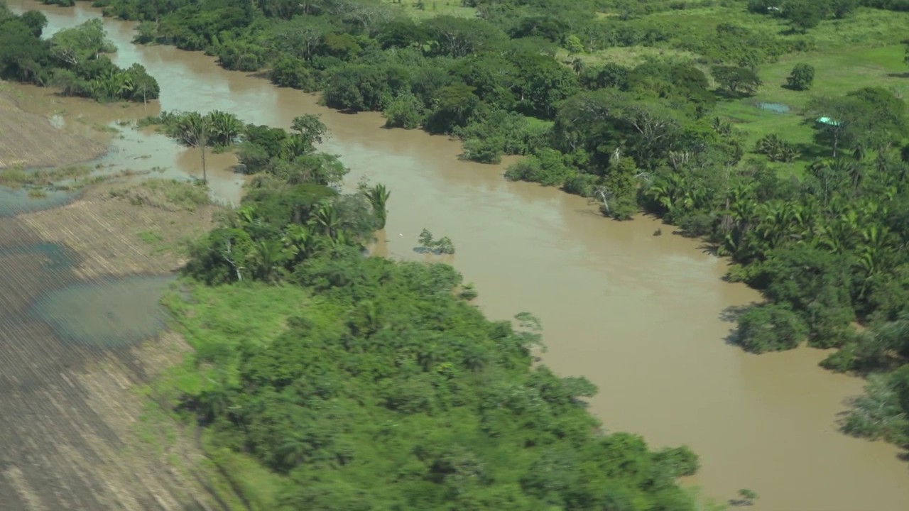
Prime Minister John Briceño returned to Belize on Friday, just in time for Tropical Storm Sara’s arrival over the weekend. In a televised address later that day, he urged Belizeans to stay calm and follow their emergency plans, especially those in low-lying and flood-prone areas. Earlier today, PM Briceño joined National Emergency Coordinator Daniel Mendez for a flyover of the affected regions. The sight was overwhelming, with water everywhere and large swaths of farmland submerged. This afternoon, we caught up with the Prime Minister in San Ignacio, where he was touring with several area representatives, including Michel Chebat, Alex Balona, and Orlando Habet. Here’s what he shared with us.
Prime Minister John Briceño
“After we looked at the record rains that we had over the weekend and looking at some of the images of the flooding that was taking place, especially here in San Ignacio, Santa Elena, Bullet Tree and in some other villages, I think it was important to come and take a firsthand look as to what has happened and the amount of damage and see what is it that we can do to rebuild and try to assist the people in this area.”
Reporter
“You have been on a [flyover], what is your assessment of the current situation and the situation coming down the river?”
Prime Minister John Briceño
“It’s lots of water. I flew all the way up to the Chalillo Dam, all the way Caracol, actually. We went into the Belize River Valley, all the way by Maskall, that whole area. We saw the Chalillo Dam, it’s overflowing, lots of water. More and more water is going to be coming down the Macal [River] and onto San Ignacio and Santa Elena and onto the villages in these areas. Our hope is that it does not rain because if it doesn’t rain, the waters are still running out and hopefully the flooding will not be as bad. It becomes serious when you have lots of rain and all of the water is coming down. We have to take into account that we have waters coming in from Guatemala. The concerns about these waters coming from Guatemala is that a lot of these villages, most of the citizens are very, very poor and they have latrines right next to the river.”
In other parts of the Cayo District, the Prime Minister reports that hundreds of acres of farmland are underwater. This spells trouble for farmers in Valley of Peace, who are facing significant losses in vegetables and other crops. The Prime Minister’s aerial damage assessment hasn’t yet included the costs.
Prime Minister John Briceño
Prime Minister John Briceño
“Here in the plains in Cayo, Santander, hundreds of acres of cane land are under water. Lots of small farmers have lost their crops, the vegetables in Cayo Central, by La Gracia, also by mile seven, that area. We have a lot of farmers that grow vegetables and their vegetables and crops are under water. Over all, what we are seeing is a lot of infrastructure damage like, for example, what we are seeing here. This small bridge that connects to St. Martin Primary School, and agricultural crops. Our small farmers are losing and we have to see, how we can fix the infrastructure, infrastructure that can now hold the kind of water that is running down and also to work with our small farmers and see how we can help them.”
Paul Lopez
“What’s the initial cost or is it too early to determine?”
Prime Minister John Briceño
“I think it’s way too early to determine. Captain Mendez was with me on the flyover, from NEMO, and they have their assessment team outside. So it’s going to be quite substantial, unfortunately, but we have to find a way. But we Belizeans are resilient and we will find a way how to rebound and to rebound even better.”