The Briceño administration recently approved an additional one point five million dollars for the National Emergency Management Organization to aid in recovery efforts. However, in the coming days, the Ministry of Infrastructure Development and Housing is also expected to submit an estimated cost for repairing the damaged roads across the affected areas.
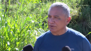
Prime Minister John Briceño
Prime Minister John Briceño
“We just approved in the budget for NEMO, in the last supplementary budget, I think we had one point five million dollars. So we have to make that available and I am sure that when we speak with Minister Espat from MIDH and their team, and they come to tell us the level of damage that our highways and in the north, the sugar roads, roads for farmers, village roads, village streets, the amount of damage that they’ve had… It’s going to be substantial. Let’s see how we could assess the damage and get it done. I think that what we want to see is that the central government gets the work done. We work closely with the mayor, I believe we respect him and he is quite active in the work that does here, certainly in the twin towns and we are here to serve the people.”
Paul Lopez “What can you tell us about residents living beyond the Bullet Tree Bridge and what they can expect by way of some sort of aid from government or any agency?”
Prime Minister John Briceño
“The very same thing that we said we were going to do in all the villages. In these areas, the area representatives are making assessments. For instance, I think it was Calla Creek that also had some record flooding but the water ran off but there was damage to property.”
The National Met Service reports that Middle Caye bore the brunt of the rain from Tropical Storm Sara. This small coral island, one of four along Glover’s Reef in the Stann Creek District, was drenched with a staggering seventeen inches of rainfall. A forecaster told News Five today that Middle Caye received the lion’s share of the storm’s downpour.
Via phone: Francisca Wellington
Via phone: Francisca Wellington, Weather Forecaster
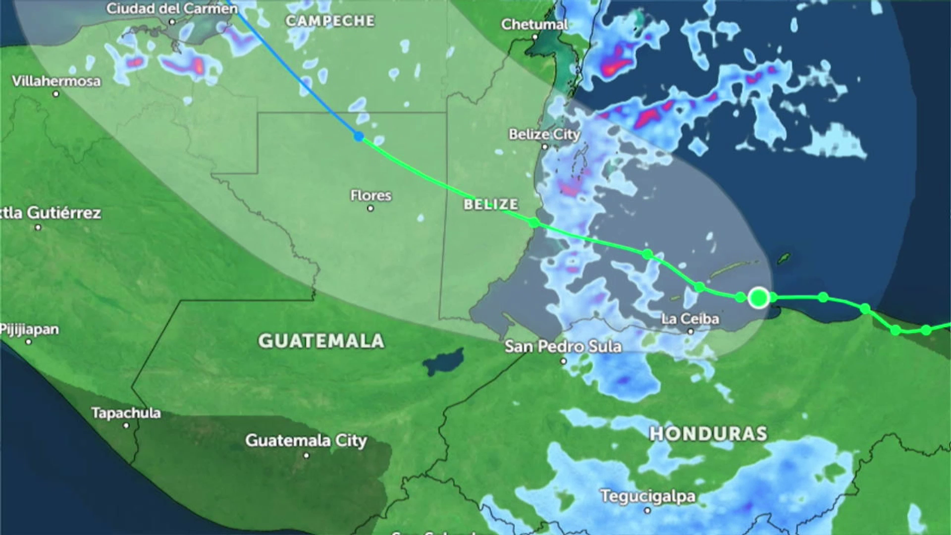
“San Ignacio for the Friday to Sunday, they recorded over three inches of rainfall. That goes for Santa Elena and Bullet Tree and then for Benque it’s over four inches. We have another station up in the Cayo District. It’s called Black Rock. It’s near the river and that recorded over four point five inches. In Belmopan there were six inches of rainfall from Friday to Sunday. We had over ten inches from Friday to Sunday and then out in the cayes. Middle Caye recorded over seventeen inches between Friday and Sunday. Remember now, the rain is not only occurring in the country of Belize. It was also occurring over in Guatemala and some of our rivers, especially the Macal River, Mopan River, this area. These rivers come from those areas as well over Guatemala. So all of that rainfall is coming down through our rivers.”
While most of the rain fell over Middle Caye, Hydrologist Tenielle Hendy explained today that the mountains to the south and west of Belize received the bulk of the rainfall. This is causing significant flooding out west. So, even though Middle Caye got a whopping seventeen inches of rain, it’s the Cayo District, which only received about four inches, that’s dealing with severe flooding.
Tenielle Hendy
Tenielle Hendy, Hydrologist
“For the central areas of the country mainly, we’re seeing flood warning in effect for those rivers. The Mopan, Belize River, Sibun River, going into the south, we’re now seeing the City River, the Bladen and Swayze branches of the Monkey River, and all those emanating off the eastern slopes of the Maya Mountains. We’re still seeing flooding and flood warning for those areas. What we do have still is the landslide threat. The landslide threat is positive for the next twenty-four hours, and it’s showing mainly in that Hummingbird Highway, Southern Highway into the south back west, towards the border with Guatemala is showing a positive indication for landslide threats. We have focused on the San Ignacio region, and like I said, it’s nine point six meters, so between twenty-seven, thirty, thirty-one feet of water we’re seeing there. The same we’re seeing now in the Mopan, where more between twelve to fifteen feet of water at the highest recorded extreme. For Crooked Tree, it’s increasing, but it’s not that it’s going to cover the causeway. We at this point, we do have reports of certain parts of the village being flooded at this time, but so far, based on the data that we’ve collected, San Ignacio has received the highest flood levels that we have seen with the passage of Tropical Storm Sara.”
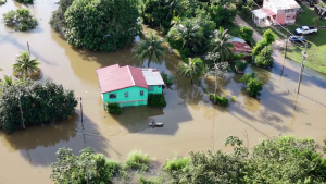
In Roaring Creek, the floodwaters from Tropical Storm Sara over the weekend are making their way from western Belize through the rivers and tributaries towards the Caribbean Sea. This means the Macal, Sibun, and Belize Rivers are among the main ones flooding right now. The water has already submerged the old bridge in Roaring Creek and is creeping under the newly elevated bridge, leaving several homes under several feet of water. Today, News Five caught up with two residents who were out surveying the scene. News Five’s Marion Ali reports.
Marion Ali, Reporting
Even though Roaring Creek is more centrally located, it has low-lying areas that are prone to flooding. Shenell Trapp was out in the flood with a canoe.
Shenell Trapp
Shenell Trapp, Roaring Creek Resident
“We’re having an experience of our life, you know, helping people and having fun fishing, touring.”
Delmarie Gordon says that so far, Sara has not affected her, unlike previous storms.
Delmarie Gordon
Delmarie Gordon, Resident, Roaring Creek
“Ih nuh too bad.”
Britney Gordon
So nothing went into your house this time?
Delmarie Gordon
“No.”
Britney Gordon
Can you tell me about the times when it was bad and water went into your house, what kind of damages did you see?
Delmarie Gordon
“Ih damage all the mattresses and the stove.”
Britney Gordon
But this time you said that you left the house on Thursday. Why is that?
Delmarie Gordon
“Because I mi gone stay da mi sista house cause mi niece mi gone out.”
Britney Gordon
“So just in case that it had gotten really bad, you decided not to stay there.”
Delmarie Gordon
“Yes.”
Britney Gordon
“And your brother is still there at this time, he’s taking care of the house?
Delmarie Gordon
“Mhmm.”
Shenell Trapp said whenever the village floods, they put aside their everyday activities to help those in need in the community.
Britney Gordon
“You tell me that every time there’s a flood, this canoe gets brought out; you guys help your neighbors. Can you talk to me about that?”
Shenell Trapp
“Yes, sometimes our neighbors stay in the house and then they call for rescue or to take food for them. So last night our neighbor over there wanted to come out around eight-thirty last night and we rescued him.”
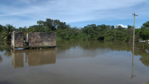
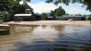
In San Ignacio, the Macal River surged above the town’s market for the first time in nearly five years. Today, it started to recede, albeit slowly. By the afternoon, market vendors were busy cleaning up. However, just outside San Ignacio in Bullet Tree, the situation looks grim. The bridge has been closed for several days, and residents beyond the Bullet Tree Bridge are either in shelters or bracing for the worst. News Five’s Paul Lopez reports.
Paul Lopez, Reporting
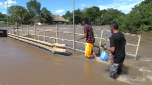
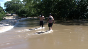
Crossing a flooded bridge is no small feat, which is why the Bullet Tree Bridge has been closed to vehicles. However, for some residents living beyond the bridge, crossing on foot is a necessity. They’re either braving the risks to get basic supplies or, like these two gentlemen, to get to work. We spoke with one Bullet Tree resident who was watching the scene unfold.
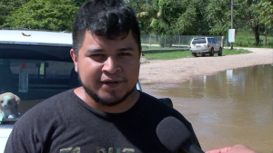
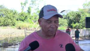
Alfonso Tesecum
Alfonso Tesecum, Bullett Tree Resident
“Right now it is not so bad right now. But the last time we did not see the river running so fast. But, right now the river is getting higher. This morning when I pass here, this road, the bridge was getting up, but suddenly it start to come again more higher. I see some people try to walk across it but it is dangerous right now. No vehicle could pass it because it almost reach by the police station and that will be dangerous.”
We then made our way across the pedestrian path on the bridge to hear from the residents on the other side. A large portion of the bridge was underwater, but the pedestrian path was still above water. Once we crossed the bridge, we found ourselves wading through over two feet of rushing water. On the other side we spoke with Robert Perez, a resident of the area.
Robert Perez
Robert Perez, Resident, Camalote
“Last night it went down almost at the entrance of the bridge. But by this morning around seven o’clock it already by that sign that says road closed. But by this afternoon we see it is where it is, an it is rising even more higher. It is affecting me big time because we are tacos vendors. We are across the bridge and not able to do our sales as normal. Then also I have my child that I haven’t returned home, because I cant cross the bridge. It is affecting me and as you can see here a lot of houses are already under water. Well at least one foot underwater.”
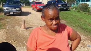
We also met a resident who, along with her family, has taken refuge in a church. She shared that her home is now submerged, and the rising river is threatening their temporary shelter, which they’ve been in since the early hours of Saturday morning. They went without potable water all weekend, but thankfully, it was restored this morning.
Voice of: Raquel Lobos
Voice of: Raquel Lobos, Flood Victim
“My uncle is back there with my aunt, because my aunt is taking care of a little old lady. They cant come out, but the river is rising and surely it will enter our house.”
Paul Lopez
“What will they do?”
Voice of Raquel Lobos
“They are on that side, seeing what it can do, but we did not expect this. We thought it was going down. But, I don’t know. It is just rising up. It is coming up and it is tough. I am in a worries right now.”
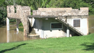
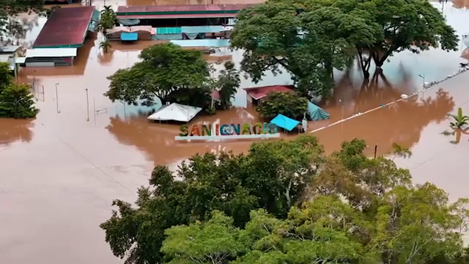
Downtown San Ignacio saw the Macal River reach Hurricane Mitch levels. Some residents saw the flood waters as an opportunity to drive their jet skis through the town. By this morning, it began to recede, and market vendors who enacted their evacuation plans on Saturday were back today to assess the damage.
Aoifa Wade
Aoifa Wade, Entrepreneur
“The water reached all the way here and you could tell all the floor is muddy and the walls they to power wash everything because the walls kept draining down. And it was not like as bad as 2020 because 2020 reached all the way to the top, but it was pretty bad. For us the wakeup sign is when it reaches the stairs behind the San Ignacio sign. It actually reached behind the bathroom area so we were like this is going to get really bad. The water just started to raise pretty quickly and we were in shock and it stayed like that for two days.”
Paul Lopez
“Have you all ever considered moving from here or why stay here?”
Aoifa Wade
“We have, because not only the weather. It is a danger to us as well, because the furniture can fall. We can get hurt. I mean, someone asked the mayor today why not move the market from the riverside. As vendors, we can’t do anything about it. We can just stay here and hope for the best.”
And so today we asked the mayor for his thoughts on relocating the market to higher ground.
Earl Trapp
Earl Trapp, Mayor, SE/SI
“It makes a lot of sense. The only good thing with being here we have the nice Macal view, but in terms of keeping the market open and service already available, I think it is a good idea to be looking at an area we can get relocate in the near future. With global warming and climate change, I don’t see it getting any better. So, you are right, we can have a lot of freak storm and river rising. I think it is an excellent idea and it is something that I will take up as a local leader and put it in consultation with the general public.”
In the meantime, as of midday, the Macal River was just below the roofs of the wooden structures on the newly built boardwalk.
Earl Trapp
“With the pressure that is coming from the Mopan River and that river is still rising. It mean that this river will take a lot longer before it recedes and before this low lying bridge becomes readily available for the people.”
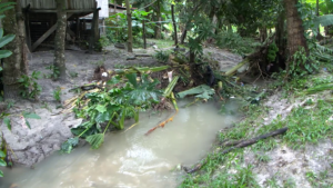
Tropical Storm Sara is set to hit Belize earlier than expected. Initially, it was predicted to make landfall around midday Sunday, but now it’s forecasted to arrive early Sunday morning. We’ll share more about the preparations and what residents, especially in southern Belize, can expect. But first, let’s head out west. On Thursday evening, the outer bands of Tropical Storm Sara brought the heaviest rainfall yet to the Santiago Juan Area in San Ignacio Town. This caused flash flooding, with the creek rising to levels residents say they’ve never seen before. Thankfully, no lives were lost, but many in the community reported damage to household items and pipelines. News Five’s Paul Lopez traveled west and filed this report.
Paul Lopez, Reporting
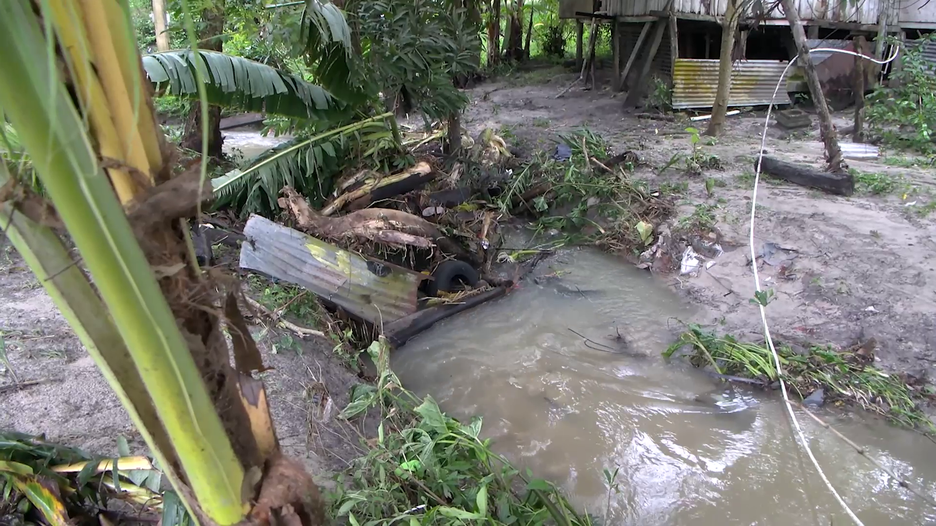
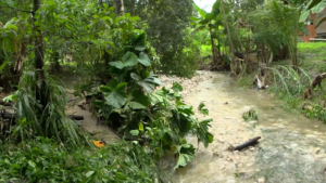
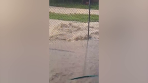
A western community is grappling with the aftermath of a flash flood that swept through properties and homes. On Thursday evening, floodwaters surged through the Santiago Juan community, off Bullet Tree Road in San Ignacio Town, reaching unprecedented levels. Video footage shows streets turning into rivers as the floodwaters rushed downhill. Today, a creek in the area stands as a stark reminder of the massive volume of water that came with the flash flood.
Voice of: Gian Rodriquez
Voice of: Gian Rodriquez, Santiago Juan Resident
“Ih mih the rain fih probably about three to four hours and I see it was nearly across the road deh.”
Paul Lopez
“For you is this something you have seen happen before?”
Voice of Gian Rodriquez
“Well, no, not really, I have never seen it reach so high yet.”
According to Chief Meteorologist Ronald Gordon, the area received the largest volume of rainfall in the country associated with Tropical Storm Sara.
Ronald Gordon
Ronald Gordon, Chief Meteorologist
“The western part of the country where the flooding was reported last night received the highest accumulation with rainfalls totaling up to about four inches. Bullett Tree recorded about ninety-four millimeter. Ninety-six point six in Santa Elena. Most of this occurred during the heavy rainfall resulting in flash flooding in those areas.”
Neiby Morales was unable to save any of her household items, as the flood waters came rushing down the creek next to her home. She sought refuge inside an abandoned, elevated, wooden structure in front of her house. She recounted the frightening ordeal when the flash flood took her washing machine downstream.
Voice of: Neiby Morales
Voice of: Neiby Morales, Santiago Juan Resident
“I didn’t expect the water was going to rise up to where it rise up yesterday. It took me to rush, to run.”
Paul Lopez
“Is it the first time it has risen so high?”
Voice of: Neiby Morales
“It is the first time. I didn’t expect to rise up to the step. It was so scary. I was by myself here yesterday. I was so scared I can tell you. I am in this one from the front, because it all wet and the things from inside, everything. Bed and the sofa and everything. How I can’t back it and it is to heavy for me to back it. It had to stay right there.”
Chief Hydrologist Tenielle Hendy explains what led to the flash flood.
Tenielle Hendy
Tenielle Hendy, Chief Hydrologist
“What we determined happened is that recall earlier this week there was about fourteen inches of rain that were received in the Maya Mountains in two different spirts. That was received overnight. Then we received additional rain yesterday and this morning. So, what you are seeing is an accumulation of these flood waters making their way down these streams. They will not all come down at once. They will come down in waves according to bankfull stage. Bank full means that the river cannot take anymore and when it cannot take anymore, it will flow overland or travel rapidly down the system.”
Thankfully, no lives were lost in Thursday evening’s flash flood. Today, residents were busy preparing for the upcoming rains as Tropical Storm Sara is expected to make landfall south of Belize on Sunday. Despite the forecasted landfall, the rain is expected to continue over the next several days.
Ronald Gordon
“In terms of rainfall forecast… forecasted from six this moring until six on Sunday, indicating that we can expect at least ten inches more of rainfall, mostly over the south according to this model from the system. Again, it is just a model. We saw what occurred in San Ignacio, Santa Elena where we had significant rainfall.”
The National Emergency Management Organization says it has deployed a team into the affected areas in the Cayo district to assess damages.
Paul Lopez
“What are the concerns for you all any at all given that the rains will continue?
Voice of: Gian Rodriquez
“From what I mih hear a hurricane mih the come. But that is until Sunday they say. So, if this done the do that, I don’t know what that could bring.”
Tropic Air has announced that all flights after four PM today are canceled due to bad weather. However, the Philip Goldson International Airport will continue to operate as usual. Event planners are being asked to postpone their events. Businesses are advised to ensure their employees’ safety. National Emergency Coordinator at NEMO, Daniel Mendez, assures that organizations are ready to respond to any requests for assistance.
Daniel Mendez
Daniel Mendez, National Emergency Coordinator, NEMO
“What we have been doing is to ensure that all of our emergency operation centers across the country remain on standby. All our district coordinators are on duty and ready to respond to requests for assistance that may arrive at our offices. All of our national committees have met, and they are prepared to implement operational plans as necessary. For us here at the NEMO secretariat we continue to monitor in collaboration with the hydrology and meteorology department and we are prepared to support response as required. We are anticipating high rainfall and strong winds and we are preparing for potential flooding in parts of the country. Points to note, as we have indicated, all interest, especially those in southern Belize must pay close attentional to this system and need to prepare their emergency plans now. Persons living in areas under flood warning must remain vigilant and be prepared to implement emergency plans as necessary. We are asking the organizers of public events are advised to postpone their events until the all clear is given in the interest of public safety. We are also asking business owners to update their business continuity plans and be prepared to implement that. Business owners in affected areas are also asked to ensure the safety of their employees. Also, considering the road conditions are very slippery, we are asking motorist to drive with extreme care to avoid accidents. We have received information that the PGIA will continue to function today as normal. Operations on Saturday may be impacted so passengers are asked to expect delays. This will be reviewed tomorrow and updated as necessary. So please look out for a statement from the Department of Civil Aviation. Also, water taxis will continue to operate today. Operations will close at midday tomorrow.”
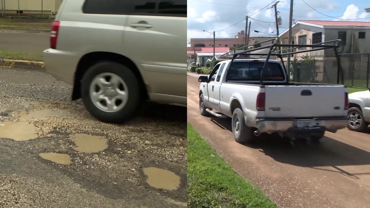
On Monday, we reported on the Belize City Council’s ambitious six-million-dollar plan to fix the damaged streets across the city. While this project is desperately needed, the council was initially unsure where the funding would come from. Despite this, work has already started. Repairs on Thomas Street, which has been in disrepair for about eight months, are now underway thanks to a collaboration between Belize Telecommunications Limited, Belize Water Service, and the Ministry of Infrastructure Development and Housing. In an interview today, Mayor Bernard Wagner explained why the repairs took so long to begin.
Bernard Wagner
Bernard Wagner, Mayor, Belize City
“That street was never to be rehabilitated It was a decent street prior to it being dogged up by BWS. It was a decent street that was in our plan to rehabilitate that street. We have people living in worse conditions than on St. Thomas Street at that point in time. So we didn’t even have that as a planned street to rehabilitate, but one of the utilities companies, brought on by certain elements went out ahead without approval from us, dug the street up and that is when it went into a real sort of state that we had to know stepping on, then we stepped in and along with the BWS, Digi, and MIDH, we were able to. It’s a street that has been funded by the city. It’s just that they are paying up front and we, we, um, offset over a period of three years, but at the end of the day, it’s a street that is still being funded by the city with the, with the exception of course of MIDH who really contributed close to three hundred twenty-five thousand towards it.”
Reporter
“So the utility companies are putting in roughly?”
Bernard Wagner
“Three twenty-ve. Each company has committed to three hundred and twenty-five thousand. Again, it’s a sort of collaborative effort. But so as not to really bring any stresses on, the council’s cash flow. over one year period, we said we’ll spread it over a three-year period instead.”
The Belize City Council’s Street Damage Assessment Report, released late Monday, reveals that the Collet constituency tops the list for the most expensive repairs needed. Mesopotamia comes in second, while Fort George and Pickstock are the least costly. The total bill for fixing streets damaged by recent rains and floods is nearly one point six million dollars. Interestingly, even though Collet is the priciest to repair, it has only ten streets and thirteen sections needing work. On the other hand, Lake Independence has a whopping twenty-seven streets and twelve sections requiring repairs. News Five’s Marion Ali gives us a detailed breakdown of the streets and the repair costs.
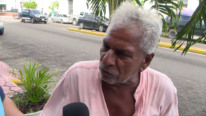
Taxi Driver
Taxi Driver
“Dehn mi have umpteen time fi do the street before the rain start, long before the rain start dehn couldda mi do it, but dehn nuh do it. Now dehn wa blame the rain now right? The street the bruk up fi we vehicle and everybody else vehicle. Come on, that da past nonsense.”
Taxi Driver
Taxi Driver
“St Thomas Street, I nuh know who responsible for it but tell the minister or whosoever responsible fi that, tell dehn goh tek a lee drive out deh and see weh di goh on out deh. The roller coaster weh mi deh by the field betta than that.”
Marion Ali, Reporting
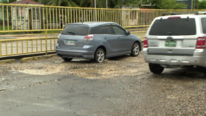
Many residents of Belize City are frustrated with the worsening condition of the streets, largely due to recent heavy rains. Mayor Bernard Wagner has assured that repairs will begin once the weather clears up. Late Monday, the Belize City Council shared a draft copy of a street damage assessment report, dated October thirty-first, detailing the number of streets and sections in each of the city’s ten constituencies that need various levels of repair. It shows the Lake Independence constituency to have the most streets that need repair at forty. That’s because while there are twenty-seven streets that need repair, three of them have more than one section that needs attention. Two of the streets, which haven’t been named, each have seven sections that need repairs. The estimated cost for materials to fix the Lake-I area is about forty-three thousand dollars.
In stark contrast, Collet, which borders Lake-I, has a list of ten streets, but thirteen sections overall that need repair. The price tag for the material to fix these streets is around four hundred and twenty-three thousand dollars. The Albert Division faces a bill of forty-nine thousand dollars for materials to fix just six streets. Over in Pickstock, eleven streets each need only one section repaired, costing about eight thousand, five hundred dollars in materials. Meanwhile, Fort George has four damaged streets, with repair materials estimated at around twenty thousand dollars. Queen Square has fifteen streets and two of them have two sections each to repair, which brings the number of sections to fix in that area to seventeen. The price for the material to repair is over two hundred and sixty-six thousand dollars.
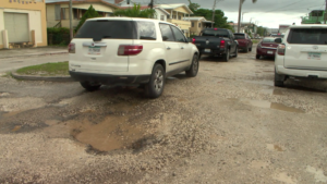
The Freetown constituency has eleven streets in need of repair, and the cost for the necessary materials is estimated at seventy-three thousand dollars. The Belize City Council will have to spend a hundred and seventeen thousand dollars to purchase material for the Mesopotamia Division, which has four damaged streets to repair. Caribbean Shores has twenty-four streets to repair at a cost of a hundred and thirty-three thousand dollars for the purchase of material. The Port Loyola constituency needs a whopping one hundred and twelve thousand dollars for materials to repair nineteen streets and twenty-seven sections. Both taxi drivers and pedestrians we spoke to agree on one thing: the streets across the city desperately need fixing.
Pedestrian
Pedestrian
“Most ah dehn got potholes soh dehn need fi fix.”
Marion Ali
“Anyone in particular?”
Pedestrian
Pedestrian
“Vernon Street right deh. Vernon Street need fix. The streets dehn terrible, especially King Street, Euphrates Avenue, Amara Avenue – all dehn streets full ah water when ih rain. And nuh ask bout potholes.”
Driver
Driver
“One ah the streets that needs to be repaired is Rivero Street because it’s in a really bad condition. That’s one of the main streets on the southside.”
Marion Ali
“Has it affected the maintenance of your vehicle?”
Driver
“Nuh really. I know for my aunt, cause my aunt lives on that street, so I think they need to fix that street. The streets dehn wa fix in due time.”
Marion Ali
“Does it affect your vehicle?”
Driver
Driver
“Yeah ih affect the vehicle but wi can’t do nothing right now because the rain nuh want give break and hold up fi mek wi fix the street dehn but as soon as the rain hold up I think the guys wa fix the street. Some ah the streets dehn bruk up and I find dehn got a lotta water, especially when it rains, and stuff like that. I think dehn need fi do something to the streets dehn.”
On November 4, 2021, Belize signed the Blue Bonds agreement with The Nature Conservancy to restructure debt and enhance marine conservation. The deal mandates that twenty-five percent of the country’s ocean space be protected, with roughly twenty percent already designated as Biodiversity Protection Zones. To meet the November 4, 2024, Milestone Four target, Belize must designate an additional five percent as Medium Protection Zones. However, concerns from fishers and experts regarding data reliability and inclusive planning highlight the need for transparency in fish stock assessments and balanced conservation efforts. Digital Editor, Hipolito Novelo, has the following report.
Hipolito Novelo, Reporting
The government’s latest conservation proposal includes regions like Lighthouse Reef Atoll, Glovers Reef Atoll, and areas east of Bacalar Chico Marine Reserve. However, some local fishermen and other stakeholders are concerned that they haven’t been properly consulted in these decisions. As Belize approaches a key deadline for its Blue Bonds commitment to protect thirty percent of its waters, tensions are rising. Fisherfolk express concern that the push to meet these conservation targets may overlook their livelihoods, highlighting the need for a more inclusive approach to marine protection. Career fisherman Dale Fairweather missed the Belize City consultation while out at sea. Fairweather believes consultations should be more than procedural steps and stresses the importance of firsthand knowledge to avoid misunderstandings.
Dale Fairweather
Dale Fairweather, Fisherman
“To me, it was basically a consultation just to meet their obligation to the Blue Bond. Well, I think that fishermen should attend all of these things so that they know what happened. I don’t think it’s a waste of time. I think it’s for the fishermen to attend because if they don’t attend, then they will be blind to what’s going on. Under the Managed Access Program, you’re allowed to fish two areas. So, if I don’t have a license for Lighthouse Reef, I might get pushed out and can’t go fish the deep water around like those reef later on then down the strip They might bring in rules because right now they say there’s no rules Say maybe here to down the road inside to put expand the inside rules all the way out to the boundary then I won’t be able to go and fish around like those reef, you know the blue water because Did this law come into effect now? But right now they say there is none. So basically, I don’t know, to me it’s like a double edged sword, you don’t know. Are you worried about that? Yes, I am worried because I’m investing in going into the deep, deep sea fishing.”
Nigel Martinez, Executive Director of the Belize Federation of Fishers (BFF), criticized the recent consultations as poorly organized and lacking essential information. According to Martinez, the Belize City meeting had minimal attendance and didn’t adequately represent those fisherfolks who are directly impacted by proposed marine zone expansions. He questioned the use of “public consultation,” suggesting it was misleading due to limited transparency, the absence of a detailed management plan, and insufficient participation from the fishing community.
Nigel Martinez
Nigel Martinez, Executive Director, B.F.F.
“When you talk about public consultation, there was no public consultation there. They did not even meet a threshold, you know, so that was alarming to me. And that’s why I came to that conclusion that it was poorly organized. I would have wanted to see a management layout of the new expansion area. Each zone should have a management plan. What are the new requirements for these expansions? How will these impact the area? What is the fisheries management of that specific area? None of those were explained. They came and they made a presentation and because the government have to meet milestone four based on the blue bond commitment, they outright don’t care whether you agree or don’t agree. At the end of the day, the SI is going to be implemented.”
Despite the Fisheries Department’s assurances that consultations are inclusive and involve diverse stakeholders, critics argue these sessions lack genuine engagement, suggesting that decisions may already be predetermined. Acting Fisheries Administrator Rigoberto Quintana points to efforts like community outreach in key coastal areas and good turnout in places like San Pedro and Caye Caulker but acknowledges limitations in reaching the full spectrum of impacted fisherfolk.
“ I must also say that this process, we have the, at the highest level, we have the Fisheries Council, that some of this work has been, the Council has been updated as this work was being done through the Coastal Zone and the Fisheries Department. And we have in that Fisheries Council, we have four representatives from fisherfolk organizations. We have Northern Fishermen, National Fishermen, the Chairman of Chunox Fishermen’s Association and we have the chairman of Hopkins Fishermen’s Association in the Fisheries Council. With this expansion based on the meeting yesterday, I can speak to yesterday and today that they are in support. The area will be open to those fishing activities that fishers are carrying out, and we’re not restricting fishers or any other activities that happen in the general rivers area. I expect that, this meeting with stakeholders will be successful because, fishers right now the sentiment is that once will not be restricted, we can continue to have access to the traditional fishing activities, then we will support this process. And the blue bonds is a legal agreement that the government of Belize signs off. Those conservation commitments by Belize is binding to the nation.”
As Belize advances its plans to expand Biodiversity Protection Zones (BPZs), local fishers and experts question whether these initiatives rely on robust data and inclusive planning. Critics are concerned that baseline data transparency issues and limited stakeholder input might overshadow the needs of fishers and accurate assessments of marine health. Reporting for News Five, I am Hipolito Novelo.