Important Forest Corridor In Belize Facing Increasing Deforestation
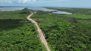
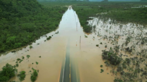
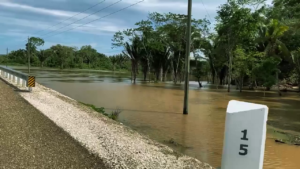
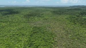
In June, when the newly constructed Coastal Plain Highway experienced significant flooding, it was attributed to deforestation. According to official data from the Forestry Department, within the last decade, eighty-eight thousand hectares or three hundred and thirty-nine square miles of forest land across Belize have been deforested. We were unable to get actual data on how much forest have been cleared along the Coastal Plain Highway, but it is enough for conservationists to raise an alarm. Experts believe that deforestation is not only leading to more significant flooding events in the area, but also posing a threat to wildlife that traverse this rich jungle ecosystem, like jaguars and tapirs. Logging and unsustainable agricultural development have been identified as the primary causes. In tonight’s episode of Belize on Reel, News Five’s Paul Lopez takes a closer look at the deforestation within the Maya Forest Corridor and the Manatee Forest Reserve, along the Coastal Plain Highway. Here is that report.
Paul Lopez, Reporting
The simplest definition of deforestation is intentional clearing of forested land. One of its negative effects is the reduction of the soil’s ability to hold water. As a result, water from heavy rainfall flows over the surface and causes flooding. Back in June, when the newly built Coastal Plain Highway saw significant flooding, and damage as a result, experts within the Ministry of Infrastructure Development and Housing pointed to deforestation as the primary reason.
Voice of: Julius Espat
Voice of: Julius Espat, Minister of Infrastructure Development
“What we have been experiencing is a part of our own making. Deforestation has become a major issue. You have to understand that trees and all of these things help with minimizing the erosion. It directs the flow of water to a specific area. Once you take that out and then it’s, a free flow.”
Voice of: Evondale Moody
Voice of: Evondale Moody, Chief Engineer, Ministry of Infrastructure Development
“Other entities created that problem for us by deforestation up stream. And based on my observation this morning we have a lot of areas where a lot of forest is cleared now where people are developing their new businesses, their new parks opening.”
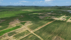
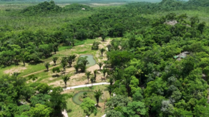
 The thirty-six-mile highway is surrounded by vast flatlands and lush forest. Fifteen miles in sits the entrance to an eco-adventure park that opened back in March of this year. The Excalibur Adventure Park sits on one thousand acres of forested land that borders the Manatee Forest Reserve to the north. So, is this eco-adventure park contributing to the deforestation that the Ministry of Infrastructure Development says has become a major issue? The company refutes any such claim. We spoke with Francis Cucul, the Manager of Excalibur Adventure Park.
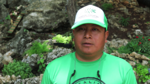
Francis Cucul
Francis Cucul, Manager, Excalibur Adventure Park
“All along the watershed we have planted, and if you look in our logo, it has the number five thousand, we have planted over five thousand key stone trees such as the Mahagony, Cedar and other fruit trees to encourage wildlife along the water shed.”
Paul Lopez
“What was considered in the development process to maintain in the development process to maintain the integrity of the rich forest in this area?”
 Francis Cucul
“So one of the things that was considered was the landscaping, the drainage of the area and reforesting in this area.”
Paul Lopez
“How are you all different than developers that come and want to clear land and make money off it as some would assume?”
 Francis Cucul
“We work with the environment and again I will emphasize on planting rather than cutting down trees. We leave trees that are already there, so we do selective clearing and if we have Mahogany tree or Sapodilla trees or any tree that has significance, we leave it there and work around it.”
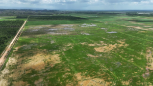
The proprietors of the eco-park have also established two conservation groups. For further context, the lands that run parallel to the highway have been deemed as a crucially important forest corridor by conservationists. It connects the Maya Mountain Massif in the south to the northern portion of Selva Maya. The Manatee Forest Reserve also forms a large part of this important forest link that jaguars and the endangered Baird’s tapirs, among other wildlife species, use to traverse the country. Satellite imagery from over the last decade reveals significant land clearing along the southern border of the Manatee Forest Reserve and even more within the area designated as the Maya Forest Corridor.
Voice of: Elma Kay
Voice of: Elma Kay, Chairperson, Maya Forest Corridor Trust
“It has come to a point where we really need to band together to save this area. Belize is world renowned for its protected area systems, but one of the gaps is the protection between those connected areas. What wildlife would this corridor be especially important for? Jaguars are wide ranging species that need large areas to sustain them. This corridor has been shrinking.”
So, it is not only the flood waters that are cause for concern along the Coastal Plain Highway. Deforestation is posing significant threats to the movement of wildlife species. The Maya Forest Corridor Trust used the June 2024 flooding as an opportunity to write to the government to highlight issues such as illegal logging and the arbitrary issuance of permits for land surveying and clearing in the area. And, while satellite imagery may not reveal significant signs of deforestation within the Manatee Forest Reserve itself, Jason Alschaft, the Chairman of Gales Point Manatee, a small Creole community along the Coastal Plain Highway, says illegal logging is taking place at an alarming rate within the reserve.
Jason Alschaft
Jason Alschaft, Chairman, Gales Point Manatee
“There is a lot of logging going on, some we have questioned, and it turned out it was illegal. Forest service (Forestry Department) came in and extracted what they have already cut and made the roads impassable again, so it was much more difficult to access the area. Sometimes we get trails where people may find a beautiful tree that they know they can make money on and harvest it. We see trucks coming and going all the time with logs, it is something I don’t know. A lot of times I see small pine trees coming out and it seems like they are getting smaller and smaller, and it seems like a lot of times what they take is a little bit more like we will just take it.”
Paul Lopez
“Would you classify the cause of the recent flooding as a result of deforestation within the Manatee Forest Reserve?”
 Jason Alschaft
“I think it could be to some degree. I think recently the change in the road and the pushing of water in different directions has really been what caused some of the flooding that we experienced. In that area that flooded and lifted the road, that is an area that floods but it’s rare. But now with all the water that is being pushed to that same river I think that is what is causing it to get close to flooding every time it rains.”
We reached out to the Forestry Department for an interview. They informed us that they were unable to comment at this time due to ongoing discussions with conservationist groups on how best to address deforestation within the reserve. In 2021, the Maya Forest Corridor Trust purchased thirty-thousand acres of land that was under threat of deforestation. Reporting for News Five, I am Paul Lopez.


Facebook Comments